Tuesday, November 30, 2010

Zion National Park, Utah

Upon seeing the valley of the Zion Canyon some 150 years ago, the early Utah pioneers proclaimed that they had arrived at Zion, their promised land. The majestic cliffs and elegant valleys carved by the Virgin River, must have been a sight for sore eyes after their rough trek through literally hundreds of miles of inhospitable terrain (commonly referred to as the “badlands”). The French trappers did not explore Southern Utah as far as we know. The Spanish did not penetrate very far. When the Mormon pioneers arrived here in their wooden wagons with their large families, they claimed the land as their own, despite the presence of Native American tribes. A pioneer named Isaac Behunin, claimed the area we now know as Zion National Park and named his homestead “Little Zion”, hence the origin of the name.

For us, Zion National Park was an optical delight, a bedazzlement of colour. The sandstone cliffs and canyons of Zion are coloured various shades of red and orange. These colours are exaggerated at sunrise and sunset and we tried to capture these sights with our not-so-trusty Pentax SLR. In parts, Zion's landscape appears sprayed with a dark rusty paint over the reds and oranges. This dark colour however, is not paint, but rust, created by iron or hematite (iron oxide), which is thought to either exist in the rocks themselves or to have been carried over them by the ground water. The rocks have also been coloured by bacteria that live on the surface of the cliffs. This bacteria ingests dust and expels iron, manganese and other minerals that then adhere to the cliff face. This creates a shiny black, brown or reddish surface which is called “desert vanish”.

Sunset at Watchman Campground
Further, our fall foliage tour remained on target, which served to only enhance the bedazzlement. The cottonwood and other trees that fill the valleys of Zion's canyons were flush gold, auburn, ochre and even a shade of apricot in parts. These colours contrasted exquisitely against the red sandstone and was entirely different from the fall foliage we've had the pleasure to indulge in before. Yes, we took a lot of photos, and we will share many more with you, dear reader, should you make further inquiries.


History
Home to several different Native American tribes throughout the ages (in particular the Ancestral Puebloans and Southern Paiute), the area that is now the national park was set set aside as a national monument in 1909 called “Mukuntuweap”, the Paiute word for “canyon”.

Horace Albright, the first Assistant to the Director of the National Parks Service (a sort of second-in-command), was the first senior parks official to visit the monument in 1918. His impression was thus:

I was surprised, excited, and thrilled. More than that, I was just plain stunned. I had no concept of the staggering beauty I beheld. Local Utah people said that Yosemite was a Mukunteweap without color. But this didn't prepare me for the reality of the towering rock walls, splashed with brilliant hues of tans and red interspersed with whites. The great towers, temples, spires, and peaks appeared unearthly as they encircled the narrow lush gorge cut by the sparkling Virgin River. It was love at first sight for me. I was so impressed ... that I was determined we should expand Mukunteweap and have it made a national park.”

Within a year of his visit, Albright had convinced President Woodrow Wilson to expand the area of the Mukuntuweap National Monument, and further convinced Congress to pass legislation transforming it into a national park. Albright also had the name changed to “Zion”, as it is easier to remember, spell and pronounce.

Zion is home to unique desert flora and fauna (67 species of mammals, 207 birds, 35 reptiles and amphibians – sorry, not sure of the stats on the flora) and, hence, in 2009 Congress designated 84% of Zion National Park as “wilderness” pursuant to the 1964 Wilderness Act.

As a sidebar, oddly enough, firearms are permitted in Zion unlike most national parks. As of Feb 22, 2010 a new federal law was passed which allows those people who can legally possess firearms under federal, Utah and local laws, to possess firearms in Zion National Park. Nonetheless, the discharge of such firearms or hunting in the park is illegal – as is the case in all national parks. Utah State Law prohibits the open carriage of loaded firearms on park shuttle buses. All this information was provided in the park's quarterly newspaper, presumably to provide comfort to those of us who don't feel at ease without their piece under their shoulder at all times.

Zion Canyon Valley

Geology
If you have a topographical map handy of the Four Corner States, we need to talk. No, seriously, if you do you can see that Zion is located in the southwest of Utah, which is also the edge of the Colorado Plateau. Bryce Canyon National Park is to the east of Zion and the North Rim of the Grand Canyon is to the south. These three geological marvels (as well as the pink, vermilion and white cliffs) are linked by a feature called the “Grand Staircase”, consisting of a series of colourful cliffs, descending in such a fashion as to appear as a massive staircase. In yet another example of the fascinating inter-connectedness of these parks, the water that runs off Zion, including the Virgin River, ends up in the Colorado River than runs through the Grand Canyon.

I'll try to describe the geology of Zion's rock layers in layman terms (God help me if I can describe it in any other fashion). The rock layers of this area has been affected by sedimentation, lithification, uplift and erosion.

Firstly, sedimentation: For each eon there is a level of stone, created by the sediments left by that eon. These sediments include the leftovers from the dinosaur age, various inland seas, etc, etc. The sediments (typically predominantly sand, mud, lime from shells and bones and gravel) of each eon are a different colour. In Zion there are nine such rock layers. The most prominent is Navajo sandstone which occurs at 2,200 feet in elevation.

Secondly, lithification: This big word describes the transformation of the sediment deposits into stone through pressure and the expulsion of fluids. During this process the layers that we see today in the exposed rock were solidified into various types of limestone, mudstone and sandstone.

Thirdly, uplifts: Earthquakes vertically hoisted parts of the Earth's crust. These earthquakes are caused by volcanoes or faulting from the collision of continental shelves. Zion is on the edge of the Colorado Platueau. The rock layers of the Colorado Plateau have been uplifted, titled and eroded. The bottom layer of rock at Bryce Canyon is the top layer at Zion and the bottom layer at Zion is the top layer at the Grand Canyon. This process is still occurring in Zion today.

Finally, erosion: This process is also continuing in Zion today. The Virgin River is still carving Zion's canyons. Flash flooding and landslides are the most visible examples of this eroding process.


What We Did
Upon the recommendation of our pals, Pete and Raluca, we camped at Watchman Campground. This campground is home to some very fine camping sites and facilities, and also one of the most charming vistas in the park - “the Watchman Plateau”. A lovely spot to sit down with a cold glass of Polygamy Porter (a local microbrewery concoction) and a cheese plate, to watch the sandstone cliffs change from orange to red, to blood red and golden, and eventually to black, when the clouds take up the tune for the final flourish of fierce yellows to delicate pink.

The most popular activities in Zion are hiking and rock climbing. We took the easy (or so we thought) option of hiking. Upon Pete and Raluca's advice we hiked the Angels Landing Trail on the first day. The elevation in Zion ranges from 3,666 to 8,726 feet and we felt every bit of it on this trail. The first couple of miles are steep, but easy enough. The trail is wide and there is always a canyon wall on one side. The last half a mile is pure torture. Not only is it basically narrow and straight up, but it has a high level of “exposure”, a term used by hiking buffs to explain that if you slip, you will fall at least 1500 feet to your terrifying, painful death. The only thing between you and the plunge should you slip is a support chain in parts of the trail. This chain is placed conveniently in the middle of the narrow trail as well, rather than either edge. Whilst on Angel's Landing Ellisha developed a fear of heights she never knew she had and had to turn back. Alex completed the trail to the landing but only because he couldn't face Pete or Raluca if he didn't finish (and later confessed that he didn't look up until he was at the top). He was rewarded by 360 degree view of Zion Canyon and a nervous tick that he's only starting to shake now, a couple of weeks later.


Angel Landing Trail in Part

The next day we went for a more horizontal hike, called the Narrows. The Narrows is a thin slot canyon that has been carved by the Virgin River. You start the trail by strolling along the Riverside Walk, a nicely paved trail that travels next to the river in a wider section of the canyon. At the end of Riverside Walk you have to start hiking through the river itself. We went on for a further 100 meters or so (enough so we would be out of sight of the people watching our progress at the end of the Riverside Walk), but the water was too cold to carry on (47 degrees Fahrenheit). We had a cup of tea from our thermos around the corner and then sheepishly turned back. When we reached the Riverside Walk junction we were once again shown up by our lack of gear. We saw other hikers preparing to make the river trek in full body dry-suits, including boots. A much better approach. They tell us that the Narrows continue for 16 miles and at portions the canyon walls are only a few feet wide. At these points the water rises to shoulder height (for people who are in the five foot zone of height). There is a constant risk of flash floods along this trail as well, in case you didn't have enough to worry about already.
The right gear.
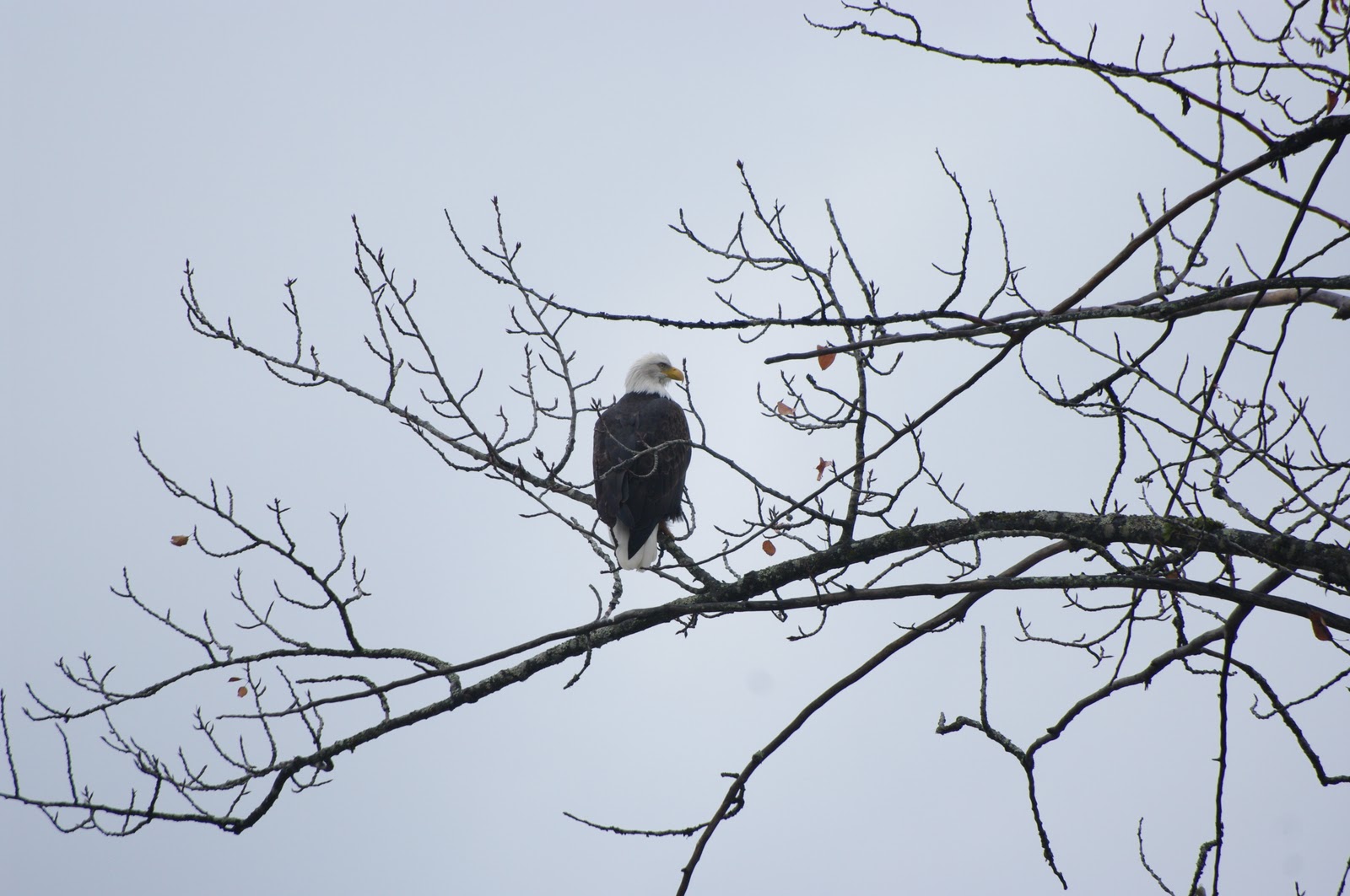
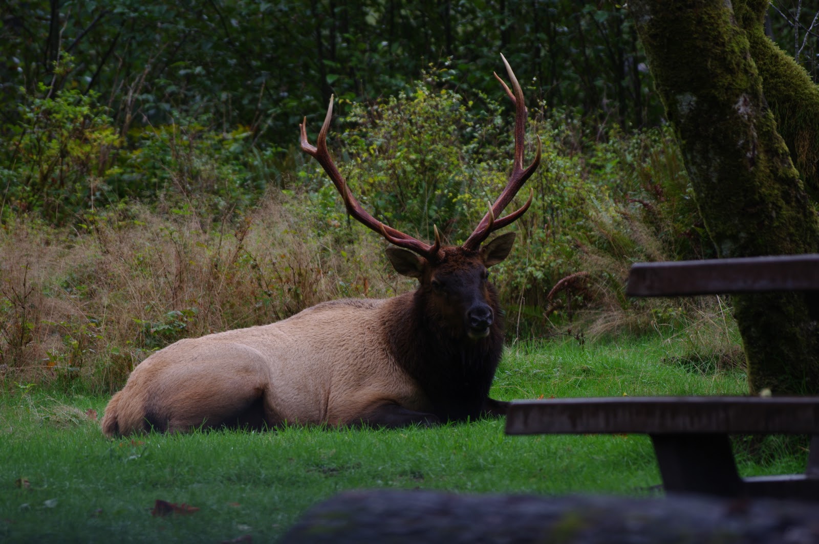
We also hiked the short trail to Emerald Pools. These pools are dirty brown and thus look nothing like emeralds and we began to speculate that this was some sort of joke that Mormon husbands pulled on their wives. (“No honey, I assure you that dirty brown rock I bought you is an emerald”). A pleasant hike nonetheless, and we encountered a startled male deer with full antlers on display along this trail.

Food
The small town of Springdale is located at the gate of Zion National Park and is home to a number of nice looking restaurants. We cheated in our camping one night and headed into town for dinner at an awesome restaurant called the “Bit and Spur”. Here we had our first taste of green chili and other Southwestern delights for this trip. The restaurant is decorated as a modern western saloon with adobe colours. We indulged in a selection of prickly pear margaritas, bowls of green chili pork verde stew, jalapeno poppers with cream cheese and cheddar, plus salsa, guacamole and chips. Still dreaming about this extravaganza.

On our way back through Zion a couple of weeks later we tried to recreate this experience but the Bit and Spur was closed. Once the tears had dried we tried Oscar's, just up the road and rejoiced to find it of comparable quality,. We enjoyed a Polygamy Pale Ale with our burritos and chili and agreed that you could justify a trip to Zion for the food alone.

Conclusion
Zion is definitely one of the finest national parks and probably the highlight of Utah's selection, although this is a very tough call to make. Utah boasts an embarrassment of national parks, including Bryce, Canyonlands, Arches and Capitol Reef. Because there are so many common features in these parks (similar rocks, trees, animals, history), it is great to visit them together. You find that by the third or fourth park you can skip most of the interpretive materials and just appreciate the twisting, collapsing, layering and wearing shapes that eternally restless nature presents at this particular speck in time.

We returned to Zion briefly a few weeks later after our initial trip, on our way to Las Vegas National Park (highlights including the Strip, Ceasar's Palace, sports betting, casino gambling and intense eating and drinking experiences). By this time the first snows had fallen for the season and another aspect of Zion's beauty was revealed to us – glistening speckles of white dusted along the red cliffs. Zion here on Earth.


Winter in Zion

Monday, November 22, 2010

Accommodation in the Internet Age

Our plan of attack when it comes to accommodation on this trip is that we try first to camp, but if we can't find a campground suitable before sundown or it's too cold, wet or windy to camp, we look for a “Mom and Pop” motel. For our readers who are not accustomed to this American institution, “Mom and Pop” motels are family run motels that are not chain motels or hotels. Most of the motels that dot the highways and interstates these days are big brand name chain motels, such as, Motel 6, Super 8, Holiday Inn, Doubletree Inn, Best Western, Comfort Inn, Days Inn, etc, etc. These types of motels are nice, clean and you get what you would expect in terms of services and facilities all the way down to the biscuits and sausage gravy with all-styrofoam crockery you get for breakfast. No surprises. Well, the Green Blazing team likes surprises, that is why we go for the oft kooky and unusual “Mom and Pop” motels. Sometimes they are a little cheaper too (but not always).

So, when we don't camp and we need a motel, we find our accommodation accordingly:
  • Whip out Droid phone and use GPS app to locate all of the motels and hotels in the region.
  • Eliminate all chain motels.
  • Read the Google reviews for the remaining motels.
  • Make selection based on reviews.
Now the reviews are the really good part of this process and we nearly always find ourselves in stitches (mixed laughter and nervous sickness kind of stitches) after reading them. Here are some of the most intriguing reviews we've come across. (Names of motels have been removed, not because we don't want to embarrass the owners, but because we don't want you to know that we were considering staying in such a place). Of-course, the funniest reviews are negative ones, which is why they are over-represented below.


OMG Never Again”
“OMG! So first thing I noticed is the dead, crispy, dry frog in the bathroom. When was the last time they cleaned this room?? I then called the front desk to complain and have them take care of it and what do they say? "Well, can't you just get some toilet paper and pick it up and flush it?" WHAT??? Then I noticed there is a bar of used Dial soap on the sink that isn't wrapped and come to find out, they don't use Dial, housekeeping put they soap someone else brought, used, and left, on the sink for the next person to use. And when I picked it up with toilet paper to throw it away there was a PUBE on the bottom! (Oh Also I'm from Washington where you can't smoke indoors anywhere and the place is reeking of cigarette smoke in the non smoking room.) Then my uncle staying down the hall calls and says he has to move rooms because there's no running water in his room. When he called the front desk they offered to give him a key to another room to borrow the shower! He insisted on getting a new room. I got more mosquito bites in the room than I did outdoors and the morning when we were packing up to leave I had to strip the bed to find my sister's lost toy and there was a beetle running around in the sheets on the bed we were sleeping in! Service in the restaurant was terrible and slow and the "hot" food was served luke warm/cold and there are not options for vegetarians. YUCK. It feels like a rain forrest in your room when you first walk in. The hotel is in a 100 degree weather pattern during the summer and they leave it up to you to start the AC when you get in. Why wouldn't they just have this on at all times or at least the morning of the day you're suppose to check in. This place was a HUGE let down. My mom was SO embarrased to have reserved these rooms for our extended family.”


They Wouldn't Let My Pet In The Lobby”
“The woman was very unpleasant. She couldn't find my reservation. It was 95 degrees outside and she wouldn't even let me into the lobby to register with my 5 lb. pet chihuahua. I waited 20 minutes in the car with the air conditioner. The room was horrible & smelly, I didn't stay and I am going to dispute the 1 night charge!”


Wouldn't Stay Here Again”
“Our room was supposed to be non smoking--even had a sign on the door for non-smoking--but upon entering the room we were bombarded by the stench of smoke and there were even ashtrays on the table!! It was just old and cheap and gross feeling. Wouldn't go back. Oh and the Riverside Exotic Experience is right next door...(I guess to some that might be a good thing but not us). I will say the one staff person we interacted with was nice and polite, check in was easy. We checked in at 2am and had no problems. It was also cheaply priced. But still next time I'll shell out a few extra bucks and stay somewhere cleaner and nicer.”


Terrible Place”
“We needed an affordable place, the sign read 26.99 a night, it ended up costing me $66.00 and a dirty room, looked like it had never been vacuumed under the beds, and my grandaughter found a pill under the edge of the bed, thank goodness I caught her trying to put it in her mouth, but the worst part was when we pulled the sheets back there were pee stains, food and just plain ole dirty, when I told the manager about it he didn't offer me a refund, he just got on the phone and called the housekeeping and put me on the phone with them, if anyone knows who owns this place I would really like to know, I had my 2 children and my 9 month old grandaughter”.


Not Again”
“For last 6-8 years I've spent the first or second week of August. I've generally been pleased except for two experiences with the office staff in each of the last two years. The last incident involved a discussion of the absence of blueberry muffins on the breakfast menu. The response was curt and offensive. Good PR would have been to respect my regret without signaling to me that my opinion and question were not welcome. This ruined my stay.”


Keep on Driving. OR READ THE FINE PRINT”
“We spent 2 weeks on the road & this was the worst motel experience we had. The proprietor was unfriendly when we checked in and we should have left then. The breakfast offerings were stale and there are signs saying you cannot take food to your room. After tasting the food, I left. I'm sure that's the idea. We were also charged $100 on our credit card bill in addition to the cost of the room. When I called about this unauthorized charge, the woman I talked to was VERY rude and accusatory and quite aggressive. She said someone had smoked in the room and that my husband had signed a paper authorizing them to charge our card if the room was smoked in. I explained that neither of us smoke. She said that she went in the room right after we left and the fan was on and it looked like we were trying to hide the smoking from her. We did NOT smoke in the room and take showers before we leave motels and leave a fan on to take out the mist. We had to pay the $100 because my elderly husband did not read the fine print and these folks are NUTS. Can we say Children of the Corn!!!”


Bait and Switch
The proprietor of The XXX Inn, XXX, is an opportunistic shyster. In addition to making multiple inappropriate comments - to include offering to send my boyfriend to the Best Western (*wink*wink*) - he is running a total bait and switch operation.
When we called to inquire about rooms, we were told the only availability was a suite that slept a family of 6 - 8. Given the fact they were unlikely to book such a large family last minute, XXX was happy to reduce the $220 charge to a regular room rate of $159. Upon checking in, however, he informed us that we had been moved to a “standard condo” and then produced a map to show us the location. Even when I realized it was off The XXX Inn's actual property, I was optimistic the accommodations would be up to par and along the same lines as the Inn. I regret being so wrong....

The “condos” are glorified, smelly apartments located right next to a trailer park with walls so thin we could hear the guy next to us talking, coughing, phone ringing, etc.

When confronted by our upset, XXX commented that the condos were “the only bed in town” that night but they weren't. There were other accommodations available to us, we CHOSE The XXX Inn because we thought we were staying THERE. The local Chamber of Commerce admitted to having received similar complaints in the past and have even had to meet with XXX to discuss. He claims he is making it clear to clientele that they are being put in condos not directly affiliated with The XXX Inn but he is NOT. Furthermore, The XXX Inn had a "Vacancy - Walk In Special" sign up the whole weekend which means he is luring people in and then redirecting them to this trash piece of property.

I now find XXX’s disrespectful comment about the Best Western ironic given that I would have much rather stayed there.


BEST PLACE EVER. YOU CAN TAKE MY WORD FOR IT”
“If you ever find yourself driving on the very long MT-2 from Medora, ND, to Glacier National Park, Montana, this is a perfect place to stay. It’s only 100 miles east of Glacier, and there’s not much out there other than chain motels; even those are few and far between.
I can honestly say this B&B is the best place I have ever stayed. It’s more than a B&B; it’s a nice house with a big living room, dining area, and kitchen with full frig and microwave. The bedroom has a magnificently comfy overstuffed bed with crisp sheets and comforter. The best is a bathroom to die for. It’s huge with a steam walk-in shower that is wonderful! As someone who pays attention to every detail, I particularly noticed the big, cushy, fluffy towels, and wonderful soaps, shampoos, delicious home-made creams and other items that you would only get in a fancy spa! The place is so clean and fresh and like your own home (only better and cleaner!).
There is full Dish cable with more channels than you can ever watch. The innkeepers keep the place supplied with many books, magazines, and beautiful music CDs to listen to. There is also free wi-fi that’s very fast.
The innkeepers are wonderful. After saying hello to Patty, it seems you have known her your entire life. They are friendly and nice and a pleasure to be around. Her husband Philip came out and greeted us when we drove up.
The best for last: The breakfast. Gourmet doesn’t begin to describe it. Wonderful pancakes with huckleberry jam, espresso, and regular coffee. There were eggs and home-made applesauce and everything was more delicious than the next. Best orange juice I have ever had – and I’m from Florida!! Sure beats a frozen bagel on a Styrofoam plate at a chain hotel!
The price is much less than I have paid for this quality of B&B, and price-comparable to a Holiday Inn that’s an hour farther east. It was $95 a night (May, 2010), and the HI was $100. Extremely reasonable!
I could drone on for hours, but I’m sure you get the idea. You will just have to take my word for it – this is the best place I have stayed. Five stars aren’t nearly enough!”

Thursday, November 18, 2010

Mount Rainier National Park, Washington

Waking up in our tent in a state park just south of the Canadian border, our first thought was of the famous Seattle coffee. Trying to make Salt Lake City the following night as well as check out Mount Rainier en route, we had precious little time to dilly dally and the best coffee we could manage was from a stand in a mechanic's yard outside Tacoma. The coffee was a little disappointing, but better than you would think.


Mount Rainier, on the other hand, was not disappointing at all, and better than both of us thought it would be. Famous for making its own weather, Mt. Rainier is a massive volcanic cone standing at 14,410 feet (just 23 foot shy of Mt. Egbert, the highest peak in the Lower 48). Warm, moisture heavy air flowing east from the Pacific Ocean hits its noble western slopes and is forced upwards, condensing to clouds. This effect produces some monstrous precipitation numbers for the towns on the western flank of the mountain – most famously Paradise, which receives an average of 680 inches of snow in a season and 126 inches of rain annually. In the winter of 1971-2, Paradise received 1,122 inches, a world record. When we passed the mountain on the way to Olympic National Park, it was experiencing its typical weather, hence we couldn't see it, and we expected much the same this time around. We were so lucky then to see it in perfect sunshine – at least for a few hours – and made the most of it with a hasty walk through knee-deep snow to the Nisqually Glacier.


Mount Rainier is the quintessential volcanic mountain because it rises from a relatively flat plain (although it is technically part of the Cascade Mountains that include Mt St Helen, Mt Hood and Mt Baker) with even, gently sloping sides rising to the cone in the middle. There are still 27 major glaciers on its slopes, so it is always white on top. The mountain was first climbed in 1870 by a comically named pair called General Hazard Stevens and Philemon van Trump who were trapped on the mountain overnight and survived by finding an ice-cave that was created by volcanic steam vents. Every year more than 10,000 people attempt the two-day trek over ice and snow fields to the peak and only half of them make it to the top. The mountain was proclaimed a national park in 1899, making it one of the earliest national parks in the U.S. and it remains one of the most popular due to its proximity to Seattle and Portland.


Our trudge through two feet of snow to a viewpoint overlooking the Nisqually Glacier reminded us regularly of the importance of having the right gear – snowshoes in this case – and also how lucky we were to be seeing the mountain at all. Nonetheless, we made it in our hiking boots and managed to survive the smug looks of those better equipped than ourselves. No doubt it is an exquisite walk in summer when the world-renowned wildflowers are out in the alpine meadows and the path easier to locate.


As we watched the sunset on the mountain with a cup of French-pressed Illy coffee, we were struck by the twin realizations that the national parks really is America's best idea, and that coffee is Italy's. How fortunate we are to be able to pick the best of both worlds. Shortly after an easterly wind got up and we could see the clouds forming on the western slopes and dragging the cloak back around the mountain. It was amazing to see this weather pattern so plainly and in such a short period of time. Our drive back down the slopes was marked by this intense fog which brought visibility down to just a few meters.

Back in British Columbia

Prince Rupert
Our “Alaskan cruise”, via the BC Ferries and Alaskan Marine Highway, ended in Prince Rupert, a town located on the shores of the Pacific Ocean in the northwest corner of British Columbia. Upon our return from the northern most region of these United States, we were again struck by the orderliness of Canadian towns. Now doubt this level of cleanliness is a result of stringent zoning regulations and so on, the likes of which probably do not exist in many parts of the Great American Experiment. Nonetheless, we had a pleasant evening in Prince Rupert recovering our land lubber legs, before our big drive through BC back to Continental USA.

The Trans-Canadian Highway between Prince Rupert and Prince George was another overdose of spectacular mountain and lake scenery dotted with pleasant tidy towns. This stretch of highway is also known as the “Highway of Tears”. Apparently, a significant number of women have gone missing along this stretch of highway (predominantly whilst hitchhiking) and are assumed murdered. So although we enjoyed the scenery, we drove probably quicker than was necessary and Lish was sure to make very speedy restroom breaks.


Crab pots stacked on the harbour at Prince Rupert

Bald Eagle encountered along Highway of Tears.

Prince George
Like Prince Rupert, Prince George is a Canadian town named after a British Royal, King George III. (Prince Rupert is named after Prince Rupert of the Rhine). It is thought of as the capital of Northern BC and is very close to the border of the Yukon. Despite its remoteness, we had a very nice sushi dinner there. The only other tit-bit we picked up while there, is that we were advised by the receptionist at our motel, that they get a lot of snow in Prince George. I looked into this, and apparently they do get on average 216 centimeters of snow annually.

Whistler
On our way south, we overnighted in Whistler, also known as “Little Australia” or “Australia North”. There are many Australians in Whistler, even at this time of year, when it is neither the peak of the summer tourist season or the ski season. There was a moment in our hotel lobby were all of the guests checking out and all of the staff checking the guests out were Australians. I've read on the interweb that out of the 4000 odd Canadian working visas given to Australians each year, about 2500 go to Whistler to work.

Snapshot from car on the way to Whistler


There seems to be no explanation for the prevalence of Australians here, other than we know that this is a place Australians like to go. But perhaps the reason lies somewhere in Whistler's reputation as a rocking party town. Not wishing to be seen as unpatriotic, we put on our best clothes and hit the bars. It was Halloween and we were soon beckoned into a party, populated by about 200 Australians and 5 Canadians, all decked out in fantastic costumes.  Cowboys, frankenstiens, superheros, tragic skiing accidents, and even some ex-presidents took to the dance floor. The best we could come up with was dirty campers who haven't had a proper shower for a while and I'm pleased to say we nailed it.

Chilliwak
Still progressing south, we stopped in the city of Chilliwak to visit an old friend, Josh, who kindly and very hospitably put us up for a couple of nights. Chilliwak's horizon is filled with a snow capped mountain vista (the Cascades perhaps?) and tidy, organized suburbs. It is another example of an orderly and well planned Canadian city. Well done Canada.

Also while in Chilliwak, we also were exposed to the computer game “Rock Band” for the first time by Josh's friends and our new friends (and followers!) Kourtney and John. Although it was evident that we were not naturals, it was fun nonetheless and our hosts very kindly humoured our poor performances. Their hospitality ran to farce, though, when they let us win an Australia vs Canada boardgame duel. Anyone who has played a boardgame with Alex knows that his team must lose.

Vancouver
2010 has been a big year for Vancouver. Consistently rated one of the world's most livable cities, Vancouver hosted the Olympic and Paralympic Winter Games in 2010. Now it was to play host to the Green Blazing team and it proved itself once again to be “proud, resourceful and fun” (as the city promises in the Official Visitors' Guide to Vancouver). Whilst in town, we witnessed the resignation of the Premier of British Columbia, Gordon Campbell, and the largest ever lottery win in Canada's history. A charming couple won the prize and both quit their jobs the following day, pledging to invest the money and live off the interest. Sensible and oh so Canadian.


Olympic Torch in Vancouver

We did a glory alumni visit to the University of British Columbia to commemorate Alex's six months there, complete with trips to the Beanery Cafe and Wreck Beach. Although all the signs greeting you at the entrance to the long walk down to Wreck Beach indicate that clothing is optional at the beach, we were still surprised to find that some people were taking this option up (Quote Alex – “I promise you, it wasn't like this before, I don't know what's happened here...”). After being terrified by the nudists, whom, I should point out, were all male (except for one lady who was clearly mentally ill), we rushed back to the university grounds for a quick walk by Gage Dormitories and the Law School

Wreck Beach, in a section that is sans nudists

We did the obligatory Long Run around Stanley Park, and yes, I do mean to capitalize the term “Long Run”, to liken it to the “Long March” (because that's what a run with Alex always ends up being). A brief stop was allowed on the Long Run to view the Beluga whales at the Stanley Park Aquarium.
Vancouver has a diverse population, which means it has terrific food. We were treated to fresh slabs of salmon in sashimi and teriyaki forms for dinner one night at Samurai Sushi in the West End of town. We also had a real deal authentic Chinese meal in Richmond. It's hard to explain why this meal was more authentic than those presented at other Chinese restaurants, but I think it had something to do with the perfectly prepared steamed dumplings and the live crab harvesting video playing on the restaurant's television.

Now that we had had our fill of delicious fresh food, common sense people and political correctness, it was time for us to drive by the Peace Arch, head over that international boundary, and get into some greasy fast food, start lovin' liberty and talk sh*t to whomever would listen. Ah, God Bless America.

Totems of Duncan

Totem poles are important to the indigenous cultures of the Pacific Northwest, British Columbia and Alaska. Often carved from Western Red Cedar trees, totem poles typically reflect local legends, notable events or people. Often they are used to reflect the success of a tribe or village. They are not objects of worship, as the original missionaries to the area assumed.  Totem poles are historically very expensive, and for an impressive pole a carver maybe paid in hundreds of blankets for his work (blankets being the ultimate currency of the time).

The town of Duncan in Vancouver Island has over 80 totem poles within its limits. Forty-one of these totems are on display via a walking tour of the town center. Of particular note, Duncan has the world's largest in diameter totem pole, carved by First Nations artist Simon Charlie. We did the walking tour and selected these poles as our favourites.


Widest Totem Pole in the World


Totem Pole Carved by Maori Artisian


Oddly enough, Duncan also is the proud owner of the world's largest hockey stick. The stick was made for the World Expo held in Vancouver, Canada in 1986. Clearly the people of Duncan have a fasination for long, tall objects.


Wednesday, November 17, 2010

Tuesday, November 16, 2010

Mendenhall Glacier, Tongass National Forest, Alaska

As we mentioned in our earlier Inside Passage blog, the Alaskan Marine Highway ferries stop in the towns and cities along the Alaskan coast that are difficult to access or not accessible by land. Juneau, the capital city of Alaska, is one such city and it can only be reached by boat or plane. It is a picturesque city on a slip of flat land scrunched between the ocean and the steep mountains from which spring a number of glaciers. We hopped off the ferry and spent a couple of relaxing days touring Juneau and its surrounds, the highlight being Mendenhall Glacier in the Tongass National Forest.


Mendenhall Glacier is 12 miles from the center of Juneau and the most easily accessible. We rode our rented bikes out to the mouth of the glacier and spent a day wandering around the glacial lake and nearby forests. Unfortunately Mendenhall Glacier is melting at an alarming rate (according to the locals) and the glacial lake was filled with icebergs that had calved from the glacier. In fact, we saw this in action, as a large chunk of ice calved off the glacier whilst we were there. This was very cool to see, but also a little disconcerting.


 Glacial ice has a unique crystalline structure (owing to the intense pressure from the weight of the glacier, all air is pushed out of the ice) that absorbs and reflects light. This gives the ice a bluish appearance. The most intense blue occurs in crevasses and when ice breaks off, or calves, from the glacier's face. The blue colour fades as the ice is exposed to the air and the crystalline structure breaks down when the air gets back into the ice.


We also saw a bald eagle eating a salmon. Awesome 'eh?


The Inside Passage – To Alaska and Back


Sunrise over Baranof Island, Alaska

 
The Inside Passage, a waterway which passes places such as the Queen Charlotte Islands, Prince of Wales Island, Ketchikan and Glacier Bay, brings to mind romantic notions of hardened seamen, gold-rushes, explorers, shipwrecks and icebergs. These dramatic, isolated notions, that seemed to us ready only to retired captains of industry aboard luxurious cruise ships and frontiersmen with nothing to lose, is made eminently accessible by the BC Ferries and the Alaskan Marine Highway. This system of public ferries offers affordable and semi-comfortable transport through the Inside Passage, linking Seattle with the handful of towns of Southeastern Alaska and even some of the most remote towns in the Aleutian Islands in the middle of the Bering Sea. The ferries are very much public transport, each holding a cafeteria, numerous viewing lounges, private cabins, games-room and often a movie theatre. You are permitted to camp on the outside decks or roll out a sleeping bag in some of the lounges. The most populated routes run twice a week in the off-season and the least populated towns are visited once a week or even once a month for those in the Bering Sea. We learned to identify the numerous fishing vessels plying the Inside Passage, read about the adventurers of the goldminers who during the rushes used the Inside Passage, observed the historical cannery operations and the legacy of hand-loggers who prized the old growth forests wrapping the steep glaciated walls of the Inside Passage.


Lish onboard

That great, early conservationist and newest family hero, John Muir, undertook numerous trips up the Inside Passage between 1879 and 1890, and we'll defer to his descriptions rather than try to mimic his lyrical style:

The islands of the Alexander Archipelago, with the straits, channels, canals, sounds, passages, and fiords, form an intricate web of land and water embroidery sixty or seventy miles wide, fringing the lofty icy chain of coast mountains from Puget Sound to Cook Inlet; and, with infinite variety, the general pattern is harmonious throughout its whole extent of nearly a thousand miles. Here you glide into a narrow channel hemmed in by mountain walls, forested down to the water's edge, where there is no distant view, and your attention is concentrated on the objects about you – the crowded spires of the spruce and hemlocks rising higher and higher on the steep green slopes; stripes of paler green where winter avalanches have cleared away the trees, allowing grasses and willows to spring up; zigzags of cascades appearing and disappearing among the brushes and trees; short, steep glens with brawling streams hidden beneath alder and dogwood, seen only where they emerge on the brown algae of the shore; and retreating hollows, with lingering snow-banks marking the fountains of ancient glaciers.... But now scenes are brought to view with magical rapidity. Rounding some bossy cape, the eye is called away into far-reaching vistas, bounded on either hand by headlands in charming array, one dipping gracefully beyond another and growing fainter and more ethereal in the distance. The tranquil channel stretching river-like between, may be stirred here and there by the silvery plashing of upspringing salmon, or by flocks of white gulls floating like water-lilies among the sun spangles; while mellow, tempered sunshine is streaming over all, blending sky, land and water in pale, misting blue. Then, while you are dreamily gazing into the depths of this leafy ocean lane, the little steamer, seeming hardly larger than a duck, turning into some passage not visible until the moment of entering it, glides into a wide expanse – a sound filled with islands, sprinkled and clustered in forms and compositions such as nature alone can invent; some of them so small the trees growing on them seem like single handfuls culled from the neighboring woods and set in the water to keep them fresh, while here and there at wide intervals you may notice bare rocks just above the water, mere dots punctuating grand, outswelling sentences of islands.


While the scenery is undoubtedly the main feature of the trip for us, we were also absorbed into the culture of Southeastern Alaska, gaining an insight into a people who are somewhat unfairly represented to the rest of the world by the crazed Momma Grizzly (http://www.huffingtonpost.com/2010/08/04/daily-show-takes-on-palin_n_670027.html), Ice-Road Truckers and King Crabbers. It was a big change-up in our trip, being separated from our trusty Prius and the protective bubble that it represents. We were no longer a traveling couple with our own agenda, but a part of a community moving on a common path, experiencing the same weather and scenery, and sharing plans and experiences along the way. These are some of the people we met:

  • Mike and Scott, a bridge team participating in a four-day tournament staged on the ferry as it wove its way from Juneau to Prince Rupert and back via Sitka, Petersberg, Wrangell and Ketchican. These guys were way into their bridge, and were taking on some real battle-axes in their quest to capture the precious master points that are the currency of prestige in the bridge world. They played from 9am through 9pm, and during breaks would come up to our camping spot at the back of the top deck to watch the scenery and share a sneaky beer. When not playing bridge, one works for an NGO called Oceans and is passionate about protecting the last real wilderness in the USA, and the other works for the museums of Alaska, a job that involves traveling to all of the far-flung reaches of this massive state to advise and monitor the preservation and presentation of its rich cultural history.
  • [Name withheld], a fascinating man who never donned a jersey throughout the trip from Juneau to Prince Rupert, notwithstanding that the temperatures were below freezing at times and the winds were upwards of 40 mph. He is a diver and fisherman, who specializes in collecting sea cucumbers that are sold to markets in China. Upon learning that we're from Western Australia, he told me that he had spent two marvelous weeks in Broome while he was a soldier in the Vietnam War. He was shot up and was scheduled to fly to Japan for surgery, but instead bordered a plane to Broome and went AWOL for two weeks, snorkeling and scuba diving before turning himself in at the base on Gardiner Island, south of Perth, from where he was flown back to Cambodia and not even missed by his platoon.
  • Many school groups who were touring other schools for swimming meets and musical performances. One memorable night we were serenaded by a group of teens who formed a 5-person chorale that rendered a diverse repertoire from the Star Spangled Banner to Living on a Prayer and Don't Stop Believing.
  • We made firm friends with a Kiwi who'd been living in Juneau for 17 years and currently runs a bike-rental business there. We also bonded with the bar-keeps at the Alaskan Hotel, where we were staying in Juneau and on the ferry back to Prince Rupert. We met a a trucker who preferred to use the ferries than grind out the miles on the Alaskan Highway and who also had an encyclopedic knowledge of the every disaster on the BC Ferries. We met characters in book stores and a family who was relocating from Vancouver (regularly voted the most livable city on earth) to Whitehorse in the Yukon (far less regularly voted such).

Monday, November 15, 2010

Passing Time in the Pacific Northwest and Beautiful British Columbia

In the Pacific Northwest and British Columbia history feels close at hand. The wild west frontier has been crossed to be sure, but to the traveler passing by, it feels like it occurred only recently. The European settlements are new and modern, especially in the hubs of Victoria and Vancouver. The indigenous cultures are highly visible, as totem poles, long houses and the indigenous people themselves are an integral part of the north west coast society.


Trees in Pacific Rim National Park Reserve

British, Spanish and Russian explorers both sailed along North America's Pacific coastline. In 1775 two Spanish ships came ashore in the region that is now known as the Olympic Peninsula in Washington State (Point Grenville and the Quinault River to be exact). The Spanish built the first European settlement in the region in Neah Bay in 1792, but this settlement was abandoned after 5 months. It was too hard to find good paella in these parts.

Captains Cook and Vancouver (well known to our Australian readers no doubt), also played a part in the European exploration of this region. Captain James Cook landed ashore on Vancouver Island in 1778, claiming the land for Britain, as was his want. Captain George Vancouver, who earlier in his career worked as part of Cook's exploration team, separately explored the region in search of the fabled northwest passage. He never found the passage, but no doubt Vancouver learned a lot about patience and similar virtues, as his team spent about four years on this task. Vancouver is responsible for much of the charting and modern day naming of the coastal areas along the Pacific Northwest and British Columbia.

Depending on who you talk to or what history books you read, Russians were all over the Pacific coast of North America from the early 1700s. Most notable of the Russian sponsored explorers is Vitus Bering, who was actually a Dane. Bering is credited with the first European “discovery” of Alaska and the Aleutian Islands.

Pioneers moved to the Pacific Northwest in the late 1800s to farm, fish and log the timber. Port Townsend became the first permanent settlement on the Olympic Peninsula in 1851. British Columbia was separately originally settled by the Hudson Bay Company by the establishment of various trading outposts. Victoria, the provincial capital of British Columbia, wasn't established until 1843.


Provincial Parliament in Victoria, BC

In total we and the Prius spent about 3 weeks exploring this area by boat and land. Here are some highlights of our journey.

Forks, Washington

This small timber town is set amongst the dark and gloomy rainforest scenery that is typical to the Olympic Peninsula. Located in the far north west corner of continental USA, it is foggy, damp and isolated. Hence we weren't overly surprised to find shops named “Shot In The Dark” (for an espresso shop), “Moonlight Motel,” “Twilight Motel”and so on. Only when we saw the “Dazzled by Twilight” costume store and “Twilight Tours”, did it dawn on us that perhaps this town has something to do with the Twilight series of novels. A quick search on our Droid phone confirmed that this assumption was correct. Stephanie Meyers, author of the Twilight trilogy, set her novels in Forks, Washington and hence evermore it will be the home of Bella and Edward the Vampire. According to Wikipedia, tourism in Forks has jumped 600% since the publication of the series.


Port Angeles, Washington
Port Angeles is one of several ferry hubs for Washington state and is the largest town on the Olympic Peninsula with a population of approximately 19,500. We decided to take a ferry from here to Victoria, the capital city of British Columbia, Canada, a one hour ride away. Whilst in Port Angeles Ellisha picked up an awesome purple Marmot jacket (look out for appearances in upcoming blog photos). Port Angeles is a nice little town, shipping imagery and naval themes abound. Its a little hokey, but we only really realized this upon our arrival in Victoria.
Victoria, Canada
Civility, cleanliness, diversity, political correctness. These are some of the themes brought to mind upon our arrival in the city of Victoria in Vancouver Island from the remotes of Washington State. It is a beautiful harbour city, dotted with pleasant bookstores, English themed bars, coffee shops, and has a penchant for high teas and float planes. It displays a sincere sensitivity of its indigenous culture, whilst celebrating its modern day diverse nature. I would say it's a kind of British Utopia, and in fact the is a tea shop in town called “Teaopia”, which of course is fabulous. At Teaopia we both had green matcha teas infused with a herbal remedy for protection against sore throats. We also indulged in a little high tea at the Empress Hotel on the harbour. We were treated to three tiered cake plates, Royal Doulton china especially designed for the Empress Hotel, smoked salmon sandwiches, shortbreads, green tea cheesecake, strawberries dipped in chocolate and a long list of other edible delights. Highly recommended.

High Tea at the Empress Hotel, Victoria

In Victoria when you go to a Thai restaurant, you get Thai food, not some salty variation of a Chinese dish. It's been a while since we've seen this type of respectful treatment of Asian cuisine. After a fabulous Thai meal downtown, we went to watch a Canucks game on the big screen at the “Sticky Wicket,” a cricket-themed pub. I'd be very surprised if many people who frequented this establishment had ever watched a cricket game, but like all Canadians, Victorians seemed to take it in their stride and focused on the ice hockey. Support for this game sadly was quickly subdued as the Canucks got a bit of a thrashing and went down 4 to 1 in the end.

Now, dear reader, you may be wondering – Why was this city given the name “Victoria?” I will now put your curiosity to rest. The city was named thus in honour of that glorious queen of the great British Empire, Queen Victoria. The clever Canucks who chose this name no doubt were mindful of their proximity to the United States of America and their desire to seek Britain's assistance should those Americans get a little recalcitrant - as they have an inclination to do from time to time - and try to invade Western Canada. To our modern ears this idea may seem a little ridiculous, but one need look no further than the infamous “Pig War” crisis that occurred in 1859 to realize that it has not always been as peaceful in these parts as it is today. This crisis was triggered by the shooting of a pig by an American farmer. Now I'm not too sure why the shooting of the pig was so egregious, but it was shot during a period of tension between America and Canada regarding the watery border between Vancouver Island and Washington State and the ownership of the San Juan Islands located with in this stretch of water. After the pig got shot tensions escalated, and at the height of the dispute 500 U.S. Army soldiers and 3 British warships were nose to nose off the southern shoreline of the islands, not 10 miles from Victoria. Fortunately cool heads prevailed and the nations agreed to joint military occupation of the San Juan Island until the boundary could be decided. Some twelve years later Kaiser Wilhelm I of Germany (grandfather to Kaiser Wilhelm II who started WWI) as arbitrator, awarded the islands to the USA. The San Juan Islands have since been dedicated as a US National Historical Park that a handful of sailors visit in the summer.


To continue our education in civility, we spent a day at the Butchart Gardens which are on the outskirts of Victoria. Twenty hectares of manicure gardens, partitioned into a traditional Japanese garden, an Italian garden, a rose garden, a sunken garden and a perenials garden surround a stately Victorian residence that is still occupied by the Butchart family, the centerpiece of which – naturally – is the tea house.


Duncan, Vancouver Island aka “I love to have a beer”
We would have loved to have a beer in Duncan, truly, we would have LOVED to, but everything was shut. Nonetheless, it's still a great town. In fact it's an awesome town, and not just because of the name. You may not know this - and I'll forgive you if you don't - but Duncan is actually otherwise known as the City of Totems. We did a photographic journey of the 41 totems that are displayed across Duncan. Please be on the look-out for our upcoming photo essay blog - “Titillating Totems of Dandy Duncan”.

 
Ucluelet, West Coast of Vancouver Island
We went to Ucluelet in search of peacefulness and rest. Yes, dear reader, we were a little tired at this stage. Blogging may look like all fun and games to you, but rest assured, it takes it out of you after a while. Ucluelet is located on the remote wild wild western coast of Vancouver Island. It is isolated, but you can still get a stretched espresso if you need, whilst not being harassed by hordes of fans or the paparazzi. We booked ourselves into a nice little cabin and went on retreat for a week.

Retreat activities are not to be disclosed, we can't share all of our lives with you, but we will disclose that Ucluelet is next door to the Pacific Rim National Park Reserve and is also a jump-off point for the famed West Coast Trail, a coastal hiking trail that traverses 75 kilometers of wild Pacific beach front. (For more on the Pacific Rim, see below)

One further tit-bit for you before I shut the lid on retreat activities. Located within Ucluelet is the Wild Pacific Trail. The showcase of this trail is the Amphitrite Lighthouse, along with the rugged coastline and salt sprayed rainforest. This lighthouse is so popular that a local television station is dedicated to it. At anytime of the day, any day of the week/month/year, you can tune into local channel 4 and watch the lighthouse and listen to smooth easy listening background music. Even at night you can monitor the lighthouse, but it's just a beam of light circling on the screen.


Pacific Rim National Park Reserve
Established in 1970, the Pacific Rim National Park Reserve was Canada's first national park on the west coast. This area is the traditional territory of the Nuu-chah-nulth First Nation Peoples (Nuu-chah-nulth translates to “among the mountains”). The Pacific Rim National Park Reserve is still designated a national park reserve rather than fully fledged park, pending the resolution of treaty settlements with the Nuu-chah-nulth.

This park is split into three distinct areas – the Broken Islands, the West Coast Trail and Long Beach. The Broken Islands are scenic little splotches of islands that dot the park's coast. Most of the islands are rocky outcrops with a couple of pine trees, but apparently a couple of them are big enough to camp on if you're willing to kayak out there to do so. We were not willing.


The West Coast Trail, as mentioned above, is 75 kilometers long and a popular multi-day hike in summer. It was closed when we were there, so we gave the multi-day hike a miss too. Interestingly though, this trail was created specifically for shipwreck survivors. So many ships wrecked along the coast here that this trail was built to link the coastal survivor to the nearby towns. Nifty, 'ey?

We did however spend a pleasant day strolling Long Beach and its adjacent rainforest. This rainforest is very very wet and was similar to the forest in Olympic National Park, but the trees were smaller. Long Beach looks like it is an inviting beach and it is very popular with surfers, but the water is so cold (7 to 14 degrees Celsius) you can't go in without a thick wetsuit (five millimeter at least). Tides play a big part at Long Beach, and when the tide is out, an array of different sea creatures and little fishes can be viewed in the beach's rock pools.


Rock pools at Long Beach

Just north of Long Beach, at Friendly Cove, Nootka Sound, is the spot where Captain James Cook came ashore and raised the Union Jack in 1778.

Highway 4, Vancouver Island
Traveling from Ucluelet back to the eastern side of Vancouver Island, we traversed a most beautiful stretch of road and perhaps the most beautiful we have driven upon during this trip. Surrounded by the golden and rust fall foliage, the sunlight dappling through the trees, the road passes by water in many forms. A raging, flooding river traverses one side of the highway for a good portion. Waterfalls stream down the surrounding mountains, and onto the road in many spots. Deep blue lakes are flanked by mountains covered by the bright green pines. And the piece-de-resistance, a bald eagle swooped down next to the car to give as a wink as we drove by.

Schoen Lake Provincial Park, Vancouver Island
On our way to Port Hardy to board the BC Ferry to Prince Rupert, we camped a night at Schoen Lake Provincial Park. It's a lovely remote camp ground next to a lake created by a log jam. We appeared to be the only people there, except for a lone fishing pole that was rigged up in the lake. We speculated a mountain man living on his own in the wilds probably lived nearby and managed to sufficiently freak ourselves out that when a mouse ran over the outside of our tent later that night, we both jumped out of our skin perhaps slightly more than was necessary. This, together with the thought of the log jam breaching and the subsequent torrent washing away our escape route, led to a pretty early departure and a very on-time arrival at Port Hardy.

Port Hardy
Upon review of our trusty road atlas, it was discovered that we could reach Alaska by ferry from Port Hardy. Port Hardy is a small town located at the northern tip of Vancouver Island, an area that is affectionately known as “The North”. We were pleasantly surprised to find that the town was quite charming and we whittled away a couple of hours in a lovely bookcafe called the “Book Nook” and purchased some materials for our upcoming journey through the Inside Passage to Alaska. Stay tuned...

Odd historic site in Port Hardy and Alex posed as a rabbit


Tuesday, November 9, 2010

Photo of the Day - Roosevelt Elk

Olympic National Park, Washington

Fueled by our beer tasting brunch at the Bridge Port Microbrewery in Portland (where we filled our growler) we endured a 6-hour haul through driving rain to the west coast of Olympic National Park and the mighty Pacific Ocean. In so doing we completed our coast-to-coast journey through this great country, seeing some truly incredible sights, and here in the heart of the Northwest we found another. We immediately went down to the beach. It was twilight and the rain had eased but the clouds remained. We could hear the big surf rumbling in over the fine black sand and headed for it over a stack of massive driftwood logs – some at least as wide in diameter as we are tall. These massive logs, haphazardly arranged at the edge of the beach started us thinking about the perspective of this place. We began to feel very small, walking along an immense, flat beach with the roaring pacific swells on one side and the pile of monstrous logs on the other. The wet sand reflected the poor light from the sky perfectly and the low clouds completely obscured the horizon, so that shadows looked as solid as the shapes they mimicked. We felt like we had reached a limbo country, where the land ends and the sea turns into the sky. Joining us in this gloaming land were groups of three or four people, holding torches and digging in the sand. They drifted in and out of sight and at times all we could see were their torches. They were digging up clams with their lengths of pvc pipe – looking for the tell-tale bubbles as the sea ran back over the sand. Then the clouds dropped right down to the sand, enveloping us and completing the hallucination. We hurried back to the familiarity of our little room at the Kalaloch Lodge, over grotesque, bloated driftlogs, dripping with droplets from the clouds.


Kalaloch Beach

Olympic has three separate habitiat types to explore – the Pacific Ocean, temperate rain forest and mountains. The Olympic Mountains form the spine of a peninsula that was cut off from the rest of the continent by glaciers for a long period of time. Interestingly, this separation led to the “endemic 16,” a group of 16 wildflowers and animals that don't exist anywhere else. More recently, the peninsula has been inhabited for at least 12 thousand years, and local native Quinault Indians called the west coast Kalaloch, which translates to “land of plenty” in English. The Olympic Penninsula was first declared a National Forest in 1889, before our pal Teddy Roosevelt designated it as a National Monument in 1909, just as he was leaving office. This National Monument was almost named Elk National Monument, in honour of the sub-species of elk, called Roosevelt Elk, that are found only on the peninsula (their naming in turn obviously being carefully calculated to guarantee their protection). The National Monument was further protected as a national park by Franklin D. Roosevelt in 1938. In 1981 Olympic National Park was listed as a World Heritage Site and certain areas of the park were designated as “wilderness” in 1988. The designation “wilderness” is a protective overlay that Congress applies to selected public lands. Wilderness areas may not be logged, drilled or traveled by motorized transport or even bicycles. A big section of Olympic National Park was re-designated national forest (such designation would allow logging) during World War II to supply timber for the war effort.


Logs on Beach 3

Back at Kalaloch Lodge, buoyed by the assurance that the in-house restaurant “offers astonishing panoramic Pacific views and fine dining,” we settled in with a local pinot noir. After some fine local fish, we asked our friendly waiter for a cheese plate (not on the menu) with which to savour the last of our wine. He asked a lot of questions (all but “what is cheese”?), promised to ask the chef and returned with a plate of kraft singles. Fortunately, the chef had taken care to unwrap each one. This is a remote part of the world. In fact, it would probably be almost forgotten altogether if it wasn't for a recent pop culture phenomenon sourced from this region – See the upcoming blog on Pacific Northwest region for more on this.

Planning on visiting each of the eco-systems offered by the park, we set of next morning for a beach walk. It was a brilliant day, the horizon had re-appeared, the waves calmed and the place seemed a lot more earthly. As we walked a mature bald eagle left its perch on the forest edge and showed off his striking plumage with a lovely low swoop before taking another beach-side perch. Pretty soon, though, the waves started pushing us closer to the pile of drift logs massed under the beach-cliffs. The high-tide warnings that we had so optimistically swept away rang back to us as we started scrambling over the logs and noticing the odd outlier moving alarmingly in the small waves. We were forced to scramble up the cliffs and watch as the tide washed into the logs and tossed them around like twigs. In this land where everything is exaggerated, the sea is easily the most powerful force – forming the sandy cliffs, bringing the weather, playing with these massive wood slabs. It licked at the wood with soft tongues of thick foam that bely the danger of these multi-ton objects rolling and swaying at its whim. We were mesmerized by these bobbing monsters and the foam that they danced to. It was a thick, viscous foam – made from pulverized plankton, kelp, silt and wood – that reminded us of making chocolate mouse.


Foam on Kalaloch Beach

Our next eco-system was the rainforest. The Hoh Rainforest is one of the rare temperate rainforests remaining, and receives an inordinate amount of rainfall – 120 to 150 inches, or roughly 12 feet annually. This rain creates enormous trees, and Olympic National Park boasts possibly the largest Douglas Fir and Sitka Spruce in the world, as well as some really big Alaskan Yellow Cedar Trees and Regular Cedar Trees. Some of these trees are a thousand years old, and they look it. The forest looks like a Brothers Grim forest – huge trees, entirely adorned with green mosses and long beards of lichen, sometimes drooping six feet or more. The canopy completely blocks the sky, and mosses completely cover the ground, so that all light in the forest is green. It is such a fecund place, that some of the biggest trees have younger trees growing on their branches – as John Muir puts it, “like a parent holding its children in its arms.” If a tree has fallen and lets some sun reach the mosses at the forest floor, it causes the moss to steam. I imagine that the air is completely saturated, and so any additional moisture condenses into clouds. It is the wettest place in the USA, and again, it totally freaked us out.


Hoh Rainforest Trail

We walked along the Hoh River, and in some places on the river bank deciduous trees had managed to grow. Their autumn foliage displays and the gray-blue of the glacial river were literally our only relief from the green onslaught of the rainforest. At the end of this hike we took a tour of the campsite at Hoh Visitor Center and discovered a herd of Roosevelt Elk – alone without any campers to interrupt their delicate gardening. These guys were apparently very comfortable around a clean, green machine like the Prius, and we were allowed to watch them go about their business to our heart's content.


Big Cedar Tree


Stream in Hoh Rainforest

With only one more eco-system to explore, and Lish fast coming down with a cold that threatened to go all the way to pneumonia, we headed to Sol Doc Hot Springs Resort. This is a lodge within the park that exploits one of the two geothermal areas in the park. The legend told by the local Native American tribe to explain the hot springs is as follows: Long ago, two dragons inhabited the Sol Doc Valley and the Elwha Valley. Being perfectly happy in his own valley, neither dragon ventured beyond it, and so they were unaware of each other. Then one day both dragons traveled to the ridge dividing the two valleys and, upon discovering a rival so close, each flew into a rage and they waged a terrible war. Eventually, both were exhausted, and mutually agreed that they were evenly matched and neither could beat the other. They called a truce and each went back to their valleys, where they remain today, crying over their loss. The tears from this bawling form the hot springs at Sol Doc and Elwha.


Sol Duc Falls

The hot springs have been used by the Native Americans and Europeans alike for their medicinal powers, and we took to them with dedication often throughout our three days at Sol Doc. Between applications of the healing waters, we explored some of the magnificent trails through the forest to Sol Doc Falls and up into the higher country around Deer and Mink lakes. Being at lower elevation than Glacier National Park, the autumn colours are later at Olympic, and we were again treated to stunning displays on the open hillsides and around ponds and streams where there is enough light for the deciduous trees to grow. On our favourite route to the falls – called Lover's Lane – we started noticing the mushrooms and fungis bursting through the moss carpet or feeding off the giant trees, both fallen and standing. If you knew your botany, you would never be hungry in the forest.


Fungi in the forest
Unfortunately, throughout our luxurious three days at Sol Doc the Olympic Mountains remained primly clothed in low clouds and so kept us waiting for the experience of the third eco-system of this remarkable national park. For bureaucratic reasons we had to depart to Canada's fair shores with some haste, so were not able to wait for the emergence of the mighty Mount Olympus, named thus by the English sea captain John Meares when he sailed passed the coast. (Meares felt that surely this mountain was the resting place of the Greek Gods). For us this mountain would have to wait for another day.