Monday, November 15, 2010

Passing Time in the Pacific Northwest and Beautiful British Columbia

In the Pacific Northwest and British Columbia history feels close at hand. The wild west frontier has been crossed to be sure, but to the traveler passing by, it feels like it occurred only recently. The European settlements are new and modern, especially in the hubs of Victoria and Vancouver. The indigenous cultures are highly visible, as totem poles, long houses and the indigenous people themselves are an integral part of the north west coast society.


Trees in Pacific Rim National Park Reserve

British, Spanish and Russian explorers both sailed along North America's Pacific coastline. In 1775 two Spanish ships came ashore in the region that is now known as the Olympic Peninsula in Washington State (Point Grenville and the Quinault River to be exact). The Spanish built the first European settlement in the region in Neah Bay in 1792, but this settlement was abandoned after 5 months. It was too hard to find good paella in these parts.

Captains Cook and Vancouver (well known to our Australian readers no doubt), also played a part in the European exploration of this region. Captain James Cook landed ashore on Vancouver Island in 1778, claiming the land for Britain, as was his want. Captain George Vancouver, who earlier in his career worked as part of Cook's exploration team, separately explored the region in search of the fabled northwest passage. He never found the passage, but no doubt Vancouver learned a lot about patience and similar virtues, as his team spent about four years on this task. Vancouver is responsible for much of the charting and modern day naming of the coastal areas along the Pacific Northwest and British Columbia.

Depending on who you talk to or what history books you read, Russians were all over the Pacific coast of North America from the early 1700s. Most notable of the Russian sponsored explorers is Vitus Bering, who was actually a Dane. Bering is credited with the first European “discovery” of Alaska and the Aleutian Islands.

Pioneers moved to the Pacific Northwest in the late 1800s to farm, fish and log the timber. Port Townsend became the first permanent settlement on the Olympic Peninsula in 1851. British Columbia was separately originally settled by the Hudson Bay Company by the establishment of various trading outposts. Victoria, the provincial capital of British Columbia, wasn't established until 1843.


Provincial Parliament in Victoria, BC

In total we and the Prius spent about 3 weeks exploring this area by boat and land. Here are some highlights of our journey.

Forks, Washington

This small timber town is set amongst the dark and gloomy rainforest scenery that is typical to the Olympic Peninsula. Located in the far north west corner of continental USA, it is foggy, damp and isolated. Hence we weren't overly surprised to find shops named “Shot In The Dark” (for an espresso shop), “Moonlight Motel,” “Twilight Motel”and so on. Only when we saw the “Dazzled by Twilight” costume store and “Twilight Tours”, did it dawn on us that perhaps this town has something to do with the Twilight series of novels. A quick search on our Droid phone confirmed that this assumption was correct. Stephanie Meyers, author of the Twilight trilogy, set her novels in Forks, Washington and hence evermore it will be the home of Bella and Edward the Vampire. According to Wikipedia, tourism in Forks has jumped 600% since the publication of the series.


Port Angeles, Washington
Port Angeles is one of several ferry hubs for Washington state and is the largest town on the Olympic Peninsula with a population of approximately 19,500. We decided to take a ferry from here to Victoria, the capital city of British Columbia, Canada, a one hour ride away. Whilst in Port Angeles Ellisha picked up an awesome purple Marmot jacket (look out for appearances in upcoming blog photos). Port Angeles is a nice little town, shipping imagery and naval themes abound. Its a little hokey, but we only really realized this upon our arrival in Victoria.
Victoria, Canada
Civility, cleanliness, diversity, political correctness. These are some of the themes brought to mind upon our arrival in the city of Victoria in Vancouver Island from the remotes of Washington State. It is a beautiful harbour city, dotted with pleasant bookstores, English themed bars, coffee shops, and has a penchant for high teas and float planes. It displays a sincere sensitivity of its indigenous culture, whilst celebrating its modern day diverse nature. I would say it's a kind of British Utopia, and in fact the is a tea shop in town called “Teaopia”, which of course is fabulous. At Teaopia we both had green matcha teas infused with a herbal remedy for protection against sore throats. We also indulged in a little high tea at the Empress Hotel on the harbour. We were treated to three tiered cake plates, Royal Doulton china especially designed for the Empress Hotel, smoked salmon sandwiches, shortbreads, green tea cheesecake, strawberries dipped in chocolate and a long list of other edible delights. Highly recommended.

High Tea at the Empress Hotel, Victoria

In Victoria when you go to a Thai restaurant, you get Thai food, not some salty variation of a Chinese dish. It's been a while since we've seen this type of respectful treatment of Asian cuisine. After a fabulous Thai meal downtown, we went to watch a Canucks game on the big screen at the “Sticky Wicket,” a cricket-themed pub. I'd be very surprised if many people who frequented this establishment had ever watched a cricket game, but like all Canadians, Victorians seemed to take it in their stride and focused on the ice hockey. Support for this game sadly was quickly subdued as the Canucks got a bit of a thrashing and went down 4 to 1 in the end.

Now, dear reader, you may be wondering – Why was this city given the name “Victoria?” I will now put your curiosity to rest. The city was named thus in honour of that glorious queen of the great British Empire, Queen Victoria. The clever Canucks who chose this name no doubt were mindful of their proximity to the United States of America and their desire to seek Britain's assistance should those Americans get a little recalcitrant - as they have an inclination to do from time to time - and try to invade Western Canada. To our modern ears this idea may seem a little ridiculous, but one need look no further than the infamous “Pig War” crisis that occurred in 1859 to realize that it has not always been as peaceful in these parts as it is today. This crisis was triggered by the shooting of a pig by an American farmer. Now I'm not too sure why the shooting of the pig was so egregious, but it was shot during a period of tension between America and Canada regarding the watery border between Vancouver Island and Washington State and the ownership of the San Juan Islands located with in this stretch of water. After the pig got shot tensions escalated, and at the height of the dispute 500 U.S. Army soldiers and 3 British warships were nose to nose off the southern shoreline of the islands, not 10 miles from Victoria. Fortunately cool heads prevailed and the nations agreed to joint military occupation of the San Juan Island until the boundary could be decided. Some twelve years later Kaiser Wilhelm I of Germany (grandfather to Kaiser Wilhelm II who started WWI) as arbitrator, awarded the islands to the USA. The San Juan Islands have since been dedicated as a US National Historical Park that a handful of sailors visit in the summer.


To continue our education in civility, we spent a day at the Butchart Gardens which are on the outskirts of Victoria. Twenty hectares of manicure gardens, partitioned into a traditional Japanese garden, an Italian garden, a rose garden, a sunken garden and a perenials garden surround a stately Victorian residence that is still occupied by the Butchart family, the centerpiece of which – naturally – is the tea house.


Duncan, Vancouver Island aka “I love to have a beer”
We would have loved to have a beer in Duncan, truly, we would have LOVED to, but everything was shut. Nonetheless, it's still a great town. In fact it's an awesome town, and not just because of the name. You may not know this - and I'll forgive you if you don't - but Duncan is actually otherwise known as the City of Totems. We did a photographic journey of the 41 totems that are displayed across Duncan. Please be on the look-out for our upcoming photo essay blog - “Titillating Totems of Dandy Duncan”.

 
Ucluelet, West Coast of Vancouver Island
We went to Ucluelet in search of peacefulness and rest. Yes, dear reader, we were a little tired at this stage. Blogging may look like all fun and games to you, but rest assured, it takes it out of you after a while. Ucluelet is located on the remote wild wild western coast of Vancouver Island. It is isolated, but you can still get a stretched espresso if you need, whilst not being harassed by hordes of fans or the paparazzi. We booked ourselves into a nice little cabin and went on retreat for a week.

Retreat activities are not to be disclosed, we can't share all of our lives with you, but we will disclose that Ucluelet is next door to the Pacific Rim National Park Reserve and is also a jump-off point for the famed West Coast Trail, a coastal hiking trail that traverses 75 kilometers of wild Pacific beach front. (For more on the Pacific Rim, see below)

One further tit-bit for you before I shut the lid on retreat activities. Located within Ucluelet is the Wild Pacific Trail. The showcase of this trail is the Amphitrite Lighthouse, along with the rugged coastline and salt sprayed rainforest. This lighthouse is so popular that a local television station is dedicated to it. At anytime of the day, any day of the week/month/year, you can tune into local channel 4 and watch the lighthouse and listen to smooth easy listening background music. Even at night you can monitor the lighthouse, but it's just a beam of light circling on the screen.


Pacific Rim National Park Reserve
Established in 1970, the Pacific Rim National Park Reserve was Canada's first national park on the west coast. This area is the traditional territory of the Nuu-chah-nulth First Nation Peoples (Nuu-chah-nulth translates to “among the mountains”). The Pacific Rim National Park Reserve is still designated a national park reserve rather than fully fledged park, pending the resolution of treaty settlements with the Nuu-chah-nulth.

This park is split into three distinct areas – the Broken Islands, the West Coast Trail and Long Beach. The Broken Islands are scenic little splotches of islands that dot the park's coast. Most of the islands are rocky outcrops with a couple of pine trees, but apparently a couple of them are big enough to camp on if you're willing to kayak out there to do so. We were not willing.


The West Coast Trail, as mentioned above, is 75 kilometers long and a popular multi-day hike in summer. It was closed when we were there, so we gave the multi-day hike a miss too. Interestingly though, this trail was created specifically for shipwreck survivors. So many ships wrecked along the coast here that this trail was built to link the coastal survivor to the nearby towns. Nifty, 'ey?

We did however spend a pleasant day strolling Long Beach and its adjacent rainforest. This rainforest is very very wet and was similar to the forest in Olympic National Park, but the trees were smaller. Long Beach looks like it is an inviting beach and it is very popular with surfers, but the water is so cold (7 to 14 degrees Celsius) you can't go in without a thick wetsuit (five millimeter at least). Tides play a big part at Long Beach, and when the tide is out, an array of different sea creatures and little fishes can be viewed in the beach's rock pools.


Rock pools at Long Beach

Just north of Long Beach, at Friendly Cove, Nootka Sound, is the spot where Captain James Cook came ashore and raised the Union Jack in 1778.

Highway 4, Vancouver Island
Traveling from Ucluelet back to the eastern side of Vancouver Island, we traversed a most beautiful stretch of road and perhaps the most beautiful we have driven upon during this trip. Surrounded by the golden and rust fall foliage, the sunlight dappling through the trees, the road passes by water in many forms. A raging, flooding river traverses one side of the highway for a good portion. Waterfalls stream down the surrounding mountains, and onto the road in many spots. Deep blue lakes are flanked by mountains covered by the bright green pines. And the piece-de-resistance, a bald eagle swooped down next to the car to give as a wink as we drove by.

Schoen Lake Provincial Park, Vancouver Island
On our way to Port Hardy to board the BC Ferry to Prince Rupert, we camped a night at Schoen Lake Provincial Park. It's a lovely remote camp ground next to a lake created by a log jam. We appeared to be the only people there, except for a lone fishing pole that was rigged up in the lake. We speculated a mountain man living on his own in the wilds probably lived nearby and managed to sufficiently freak ourselves out that when a mouse ran over the outside of our tent later that night, we both jumped out of our skin perhaps slightly more than was necessary. This, together with the thought of the log jam breaching and the subsequent torrent washing away our escape route, led to a pretty early departure and a very on-time arrival at Port Hardy.

Port Hardy
Upon review of our trusty road atlas, it was discovered that we could reach Alaska by ferry from Port Hardy. Port Hardy is a small town located at the northern tip of Vancouver Island, an area that is affectionately known as “The North”. We were pleasantly surprised to find that the town was quite charming and we whittled away a couple of hours in a lovely bookcafe called the “Book Nook” and purchased some materials for our upcoming journey through the Inside Passage to Alaska. Stay tuned...

Odd historic site in Port Hardy and Alex posed as a rabbit


Tuesday, November 9, 2010

Photo of the Day - Roosevelt Elk

Olympic National Park, Washington

Fueled by our beer tasting brunch at the Bridge Port Microbrewery in Portland (where we filled our growler) we endured a 6-hour haul through driving rain to the west coast of Olympic National Park and the mighty Pacific Ocean. In so doing we completed our coast-to-coast journey through this great country, seeing some truly incredible sights, and here in the heart of the Northwest we found another. We immediately went down to the beach. It was twilight and the rain had eased but the clouds remained. We could hear the big surf rumbling in over the fine black sand and headed for it over a stack of massive driftwood logs – some at least as wide in diameter as we are tall. These massive logs, haphazardly arranged at the edge of the beach started us thinking about the perspective of this place. We began to feel very small, walking along an immense, flat beach with the roaring pacific swells on one side and the pile of monstrous logs on the other. The wet sand reflected the poor light from the sky perfectly and the low clouds completely obscured the horizon, so that shadows looked as solid as the shapes they mimicked. We felt like we had reached a limbo country, where the land ends and the sea turns into the sky. Joining us in this gloaming land were groups of three or four people, holding torches and digging in the sand. They drifted in and out of sight and at times all we could see were their torches. They were digging up clams with their lengths of pvc pipe – looking for the tell-tale bubbles as the sea ran back over the sand. Then the clouds dropped right down to the sand, enveloping us and completing the hallucination. We hurried back to the familiarity of our little room at the Kalaloch Lodge, over grotesque, bloated driftlogs, dripping with droplets from the clouds.


Kalaloch Beach

Olympic has three separate habitiat types to explore – the Pacific Ocean, temperate rain forest and mountains. The Olympic Mountains form the spine of a peninsula that was cut off from the rest of the continent by glaciers for a long period of time. Interestingly, this separation led to the “endemic 16,” a group of 16 wildflowers and animals that don't exist anywhere else. More recently, the peninsula has been inhabited for at least 12 thousand years, and local native Quinault Indians called the west coast Kalaloch, which translates to “land of plenty” in English. The Olympic Penninsula was first declared a National Forest in 1889, before our pal Teddy Roosevelt designated it as a National Monument in 1909, just as he was leaving office. This National Monument was almost named Elk National Monument, in honour of the sub-species of elk, called Roosevelt Elk, that are found only on the peninsula (their naming in turn obviously being carefully calculated to guarantee their protection). The National Monument was further protected as a national park by Franklin D. Roosevelt in 1938. In 1981 Olympic National Park was listed as a World Heritage Site and certain areas of the park were designated as “wilderness” in 1988. The designation “wilderness” is a protective overlay that Congress applies to selected public lands. Wilderness areas may not be logged, drilled or traveled by motorized transport or even bicycles. A big section of Olympic National Park was re-designated national forest (such designation would allow logging) during World War II to supply timber for the war effort.


Logs on Beach 3

Back at Kalaloch Lodge, buoyed by the assurance that the in-house restaurant “offers astonishing panoramic Pacific views and fine dining,” we settled in with a local pinot noir. After some fine local fish, we asked our friendly waiter for a cheese plate (not on the menu) with which to savour the last of our wine. He asked a lot of questions (all but “what is cheese”?), promised to ask the chef and returned with a plate of kraft singles. Fortunately, the chef had taken care to unwrap each one. This is a remote part of the world. In fact, it would probably be almost forgotten altogether if it wasn't for a recent pop culture phenomenon sourced from this region – See the upcoming blog on Pacific Northwest region for more on this.

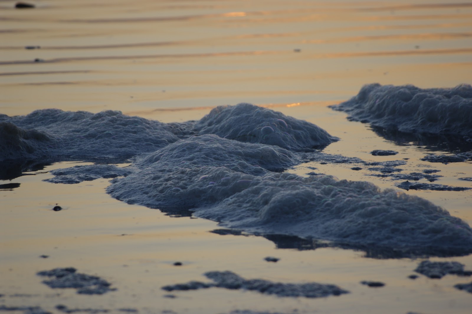
Planning on visiting each of the eco-systems offered by the park, we set of next morning for a beach walk. It was a brilliant day, the horizon had re-appeared, the waves calmed and the place seemed a lot more earthly. As we walked a mature bald eagle left its perch on the forest edge and showed off his striking plumage with a lovely low swoop before taking another beach-side perch. Pretty soon, though, the waves started pushing us closer to the pile of drift logs massed under the beach-cliffs. The high-tide warnings that we had so optimistically swept away rang back to us as we started scrambling over the logs and noticing the odd outlier moving alarmingly in the small waves. We were forced to scramble up the cliffs and watch as the tide washed into the logs and tossed them around like twigs. In this land where everything is exaggerated, the sea is easily the most powerful force – forming the sandy cliffs, bringing the weather, playing with these massive wood slabs. It licked at the wood with soft tongues of thick foam that bely the danger of these multi-ton objects rolling and swaying at its whim. We were mesmerized by these bobbing monsters and the foam that they danced to. It was a thick, viscous foam – made from pulverized plankton, kelp, silt and wood – that reminded us of making chocolate mouse.


Foam on Kalaloch Beach

Our next eco-system was the rainforest. The Hoh Rainforest is one of the rare temperate rainforests remaining, and receives an inordinate amount of rainfall – 120 to 150 inches, or roughly 12 feet annually. This rain creates enormous trees, and Olympic National Park boasts possibly the largest Douglas Fir and Sitka Spruce in the world, as well as some really big Alaskan Yellow Cedar Trees and Regular Cedar Trees. Some of these trees are a thousand years old, and they look it. The forest looks like a Brothers Grim forest – huge trees, entirely adorned with green mosses and long beards of lichen, sometimes drooping six feet or more. The canopy completely blocks the sky, and mosses completely cover the ground, so that all light in the forest is green. It is such a fecund place, that some of the biggest trees have younger trees growing on their branches – as John Muir puts it, “like a parent holding its children in its arms.” If a tree has fallen and lets some sun reach the mosses at the forest floor, it causes the moss to steam. I imagine that the air is completely saturated, and so any additional moisture condenses into clouds. It is the wettest place in the USA, and again, it totally freaked us out.


Hoh Rainforest Trail

We walked along the Hoh River, and in some places on the river bank deciduous trees had managed to grow. Their autumn foliage displays and the gray-blue of the glacial river were literally our only relief from the green onslaught of the rainforest. At the end of this hike we took a tour of the campsite at Hoh Visitor Center and discovered a herd of Roosevelt Elk – alone without any campers to interrupt their delicate gardening. These guys were apparently very comfortable around a clean, green machine like the Prius, and we were allowed to watch them go about their business to our heart's content.


Big Cedar Tree


Stream in Hoh Rainforest

With only one more eco-system to explore, and Lish fast coming down with a cold that threatened to go all the way to pneumonia, we headed to Sol Doc Hot Springs Resort. This is a lodge within the park that exploits one of the two geothermal areas in the park. The legend told by the local Native American tribe to explain the hot springs is as follows: Long ago, two dragons inhabited the Sol Doc Valley and the Elwha Valley. Being perfectly happy in his own valley, neither dragon ventured beyond it, and so they were unaware of each other. Then one day both dragons traveled to the ridge dividing the two valleys and, upon discovering a rival so close, each flew into a rage and they waged a terrible war. Eventually, both were exhausted, and mutually agreed that they were evenly matched and neither could beat the other. They called a truce and each went back to their valleys, where they remain today, crying over their loss. The tears from this bawling form the hot springs at Sol Doc and Elwha.


Sol Duc Falls

The hot springs have been used by the Native Americans and Europeans alike for their medicinal powers, and we took to them with dedication often throughout our three days at Sol Doc. Between applications of the healing waters, we explored some of the magnificent trails through the forest to Sol Doc Falls and up into the higher country around Deer and Mink lakes. Being at lower elevation than Glacier National Park, the autumn colours are later at Olympic, and we were again treated to stunning displays on the open hillsides and around ponds and streams where there is enough light for the deciduous trees to grow. On our favourite route to the falls – called Lover's Lane – we started noticing the mushrooms and fungis bursting through the moss carpet or feeding off the giant trees, both fallen and standing. If you knew your botany, you would never be hungry in the forest.


Fungi in the forest
Unfortunately, throughout our luxurious three days at Sol Doc the Olympic Mountains remained primly clothed in low clouds and so kept us waiting for the experience of the third eco-system of this remarkable national park. For bureaucratic reasons we had to depart to Canada's fair shores with some haste, so were not able to wait for the emergence of the mighty Mount Olympus, named thus by the English sea captain John Meares when he sailed passed the coast. (Meares felt that surely this mountain was the resting place of the Greek Gods). For us this mountain would have to wait for another day.

Tuesday, November 2, 2010

Olympic Dreams - Pilgrimage to the Pacific Northwest

To complete the east to west leg of our trip, we needed to make our way from the Yellowstone/Grand Tetons area to the Pacific Ocean. Our aim was to hit the coast at Olympic National Park in Washington State. You would think that this would not be a particularly arduous drive, but due to some navigational errors it took us almost 3 full days.

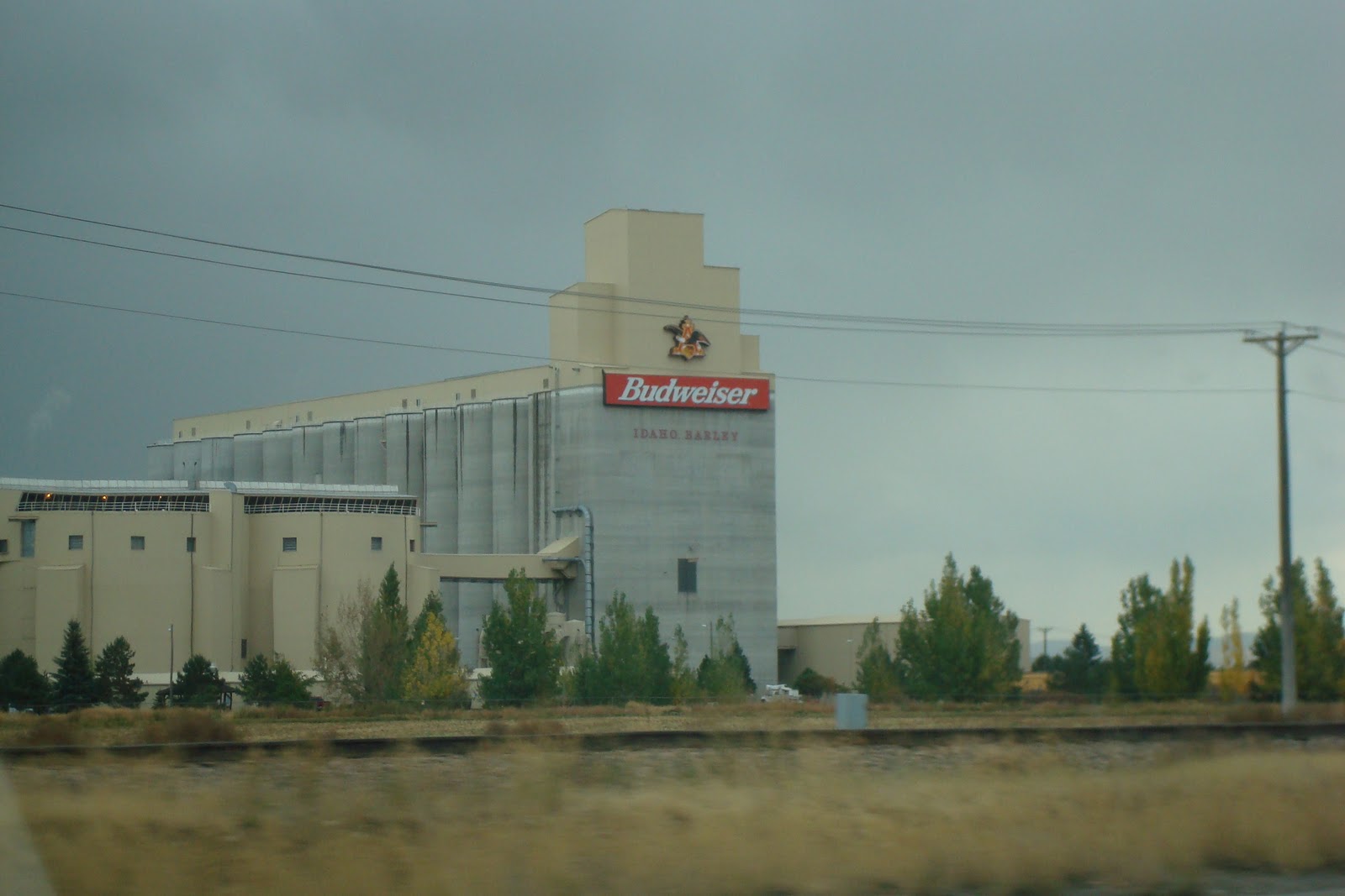
Budweiser Store in Idaho
 Jackson, Wyoming to Boise, Idaho
As mentioned in our previous blog entry, Jackson is a delightful little town. It's the kind of town we'd all like to live in – country charm with city conveniences. You can get a latte and watch you favourite local cowboy stroll down the road at the same time. It's very close to Jackson Hole Ski Area, so it's very likely that we will make a repeat visit here in the near future. However, I am a little concerned about the elevation. The vertical drop on this ski field is 4,139 feet.

Having never been to Idaho or having never met anyone who had, I always considered it a bit of a “boondogs” type place. Not true, it turns out. Not only can you get a latte and watch a cowboy, but you can also purchase delicious bagels. We highly recommend both the “Scramble” and the “Greek” from Alia's Coffee House in downtown Boise, Idaho. The98th largest city in America, Boise has the casual hip feel of a west coast town with a mix of cowboy cosmopolitan. Interestingly, Boise has the highest concentration of Basque peoples outside of the Basque area in Spain (approximately 15,000 Basqui). Uninterestingly, Wikipedia provides the following list of notable resident from Boise (I defy you to recognize one name on this list):

  • Robert Adler, inventor
  • William Agee, businessman
  • Joe Albertson, businessman
  • Kristin Armstrong, cycling gold medalist
  • James Jesus Angleton,former chief of the CIA counter-intelligence staff
  • Bill Buckner, former Major League Baseball player
  • John Sanford Cole, Navy Cross recipient
  • Heather Cox, sportscaster
  • Frank Church, U.S. senator
  • John M. Haines, mayor and governor
  • Mark Gregory Hambley, ambassador
  • Gene Harris, jazz musician
  • Michael Hoffman, movie director
  • Howard W. Hunter, religious leader
  • Dirk Kempthorne, mayor, governor, senator, and secretary of the interior
  • George Kennedy, actor
  • Mark Levine, jazz musician and educator
  • Bonnie McCarroll, rodeo performer
  • Doug Martsch, musician and songwriter
  • Brett Nelson, musician and songwriter
  • Reginald Owen, character actor
  • William Petersen, television actor
  • Thom Pace, musician and songwriter
  • Jake Plummer, football quarterback
  • Paul Revere, musician
  • Frank Shrontz, businessman
  • J.R. Simplot, businessman
  • Robert Smylie, governor
  • Gary Stevens, jockey
  • Curtis Stigers, musician and songwriter
  • Kristine Sutherland, television actress
  • Wayne Walker, football linebacker and broadcaster
  • Viola S. Wendt, poet
  • Torrie Wilson, model, entertainer and professional wrestler
Incredible, 'ey? You never heard of one person on this list, have you?

Missing Montana and feeling a little out of place in the semi wild west environment, we also stopped in a Hap Tallman Stockman Store (http://www.haptallman.com/) to pick up some western wear. Alex is now the proud owner of a pair of awesome cowboy boots, and Ellisha picked up a couple of cute little cowgirl tops.

Boise, Idaho to The Dalles, Oregon
We went in search of the mythical Hells Canyon, alas never to be found. This canyon is apparently the deepest in the world, and thousands of feet deeper that the Grand Canyon. We did about a four hour detour to find the lookout for the canyon, only to be told when we later stopped for fuel, that the road washed away in 2006. It seems odd that this natural wonder would not be exploited for commercial gain by some enterprising American, but it seems that it is not. The canyon does have a river and several dams along its path, boat fishing seems to be the main interest in this area.

Arriving in East Oregon we were greeted with a dramatic sunset. Photograph, thousands words, etc.

By nightfall we had arrived at the Cousins Country Inn in The Dalles, Oregon (State Motto: “She Flies With Her Own Wings”) a charming little town on the Columbian River, best known as the location of the first and only biochemical terrorist attack in America. Yes, you did read correctly – there has been a biochemical terrorist attack in America. The perpetrators were the Rajneeshee Cult and the attack occurred in 1984 when cult members purposely infused local salad bars with salmonella. 751 people contracted salmonella from this attack, 45 were seriously ill, but there were no fatalities. The Rajneeshee perpetrated this attack in an attempt to take over the local government of The Dalles in an upcoming election. Their reasoning being that if all the towns people were too sick to vote, all the Rajneeshee candidates would win.

Anyway, we had a very nice non-salmonella infused meal at the Cousins Country Inn – Meatloaf for Alex and Chicken fried steak for me. Hmmm delicious.

It was free DVD rental night at the Inn, so we ordered a dose of “Into the Wild,” [SPOILER ALERT] a depressingly sad movie about a guy who goes on a road trip (not too dissimilar to ours) and eventually starves to death. Neither of us felt great about going to sleep that night.

Sage bush in Oregon

 The Dalles, Oregon to Portland, Oregon
We drove through the Columbia Gorge in a rain fog. It could have been spectacular. There were hints of scenery that suggested that it was incredibly beautiful. But unfortunately it rained a heavy downpour our entire drive. We saw the Columbian River through a foggy maze, glimpses of waterfalls and glints of sun on patches of the gorge face, but not enough to say we really saw it.

A little disheartened, we decide to visit a microbrewery in Portland, a regional specialty. We were not disappointed – Bridge Port Brewery (http://www.bridgeportbrew.com/). Big lunch and a sampler tray, we were back in good spirits, and off to our next mecca – Olympic National Park in Washington State (State Motto: “Alki”, a Chinook Indian word for “bye-bye” or “hope for the future”).

Columbia River Gorge


Grand Teton National Park, Wyoming

Grand Teton National Park is right next door to Yellowstone National Park and the admission fee to one park grants you admission to the other. The main feature of this park is a chain of mountains, the Tetons, that abruptly rise out of the surrounding prairie. In my opinion, humble as it may be, Grand Teton is more like a typical national park than Yellowstone. There are less people, plenty of available camping sites in October, easily accessible hiking trails, a great cycling path and it feels more secluded and just generally calmer.


We are told that the word “tetons” means “boobs” in French. The story behind the name of the park and its mountain range is contested, but apparently it was named by the French fur trappers who were the first Europeans in this part of the world. These men, long from the comforts of home, thought that these mountains looked like breasts and named the range accordingly. I admit that the mountains are lovely and shapely, but it's a pretty long bow to string to say that they look more like boobs than any other set of mountains. Perhaps those lonely French trappers were pining for their women-folk particularly keenly when they got to the Tetons. As Confucius says - “To a man carrying a hammer, everything looks like a nail”.

Upon our arrival, we found a nice little campsite at the Signal Mountain Campgrounds and had a relaxing evening at Jackson Lake and around the campfire. Jackson Lake is particularly lovely at sunset. As you look to the west across the lake, the stately Tetons gracefully fill the backdrop, with glints of pinks, oranges and gold dancing across the darkening sky.


After the hoopla of Yellowstone, we were in need a wind-down and an early night. Not to be. Around 1am our sleep was disrupted by a rustling and a hooting noise. It woke us both. It was definitely an animal sniffing around next to the tent, but what kind of animal? Alex clutched the bear mace and removed the safety, Ellisha clasped the massive mag-light torch (many thanks to Duncan and Emily for this gift). The rustling continued for about 15 minutes while we freaked out in our tent. This was not helped by some other campers freaking out a few campsites away (we could hear their nervous chatter in the wind). We decided to stay in the tent and not explore until morning. In the morning we couldn't see any footprints around the campsite. We tracked down the ranger, who told us that it was probably a bear. He quite candidly told us that they've had a whole bunch of bears around the area for a while now.

We decided bravely, in the clear light of day, to do a hike into the mountain range. This was a bonnie little hike along Jenny Lake and up through the Cascade Canyon, between some of the peaks in the Tetons, stopping at Hidden Falls and Inspiration Point (interestingly there was an Inspiration Point in Yellowstone as well). The Tetons are a raggedy line of peaks that rise abruptly over Jackson Lake and the valley through which the Snake River runs. They are amongst the youngest formations in the Rocky Mountains. Around eight million years ago, once the rest of the Rockies were formed, the earth's crust relaxed and stretched, opening an 80-km long fault that pushed the Tetons up and the valley floor down, to make the Jackson Hole. Before the hole filled with sediments (5.5 kilometers of sediment to give you an idea), the Tetons rose 7.3 kilometers above the floor of Jackson Hole!

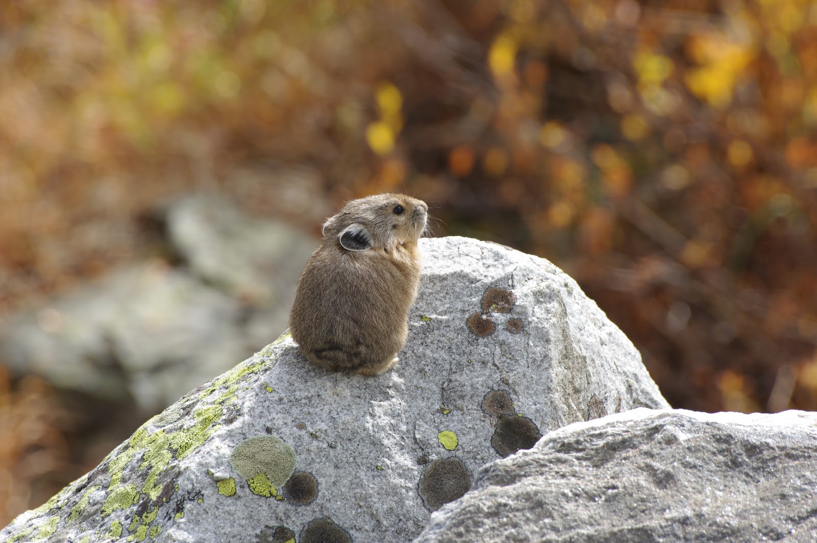
Besides the resplendent fall colours, which had re-appeared as we headed south from Yellowstone, we also saw a new mammal called a “pika”. (The exact species name is the American Pika, Ochotona princeps). This guy looks like a hamster, sits on rocks in mountainous environments and makes little bleating noises to its pals. Unfortunately, he doesn't look like he sees or hears too well and probably gets a lot of trouble from eagles and hawks. Later back at Signal Mountain, we also got a sight of a American Marten, which is a bit like a feline weasel. Fortunately, we did not encounter any bears other than our phantom night bear. Just in case you were wondering what we would do if we encountered a bear, please read this extract from the Cascade Canyon Trail Guide:
“IF YOU ENCOUNTER A BEAR Do not run. Running can elicit an attack. If bear is unaware of you, detour quickly and quietly away. If the bear is aware but has not acted aggressively back away slowly, talking in an even tone while waving your arms.
AGGRESSIVE BEARS If a bear approaches or charges you, do not run. It will increase the chances of attack. Do not drop your pack; it may protect your body if attached, bears often “bluff charge,” stopping before contact. Bear experts generally recommend standing still until the bear stops, then backing away slowing. Climbing trees is no protection from black bears and may not help with grizzlies either. If you are knocked down, curl into a ball protecting your stomach and back of your head and neck.”

With this in mind and the careless advice of our camp ranger that morning, we decided to camp another night at Signal Mountain Campground. We collected our firewood (collection of lake driftwood under 3 feet in length is allowed in this national park), shared a few beers (specifically Teton Ale by Grand Teton Brewing Co.) and some campfire chilli, and ... slept soundly through to 9am without disturbance. Phew!


On our way out of the park we stopped in Jackson, primarily to enjoy singing the Johnny Cash and June Carter Cash duet that we'd been practicing, and also to take a look at the art galleries that are clustered there. We did a tour of the National Wildlife Art Gallery which is located next to the Elk Winter Refuge on the outskirts of Jackson. This resident elk herd is corralled here in winter. Naturally, the gallery is filled with many interesting paintings, sculptures and photographs. Much of the gallery is noteworthy, but in particular there was an excellent temporary exhibit of Michael Forsberg's photos of the Great Plains. Check his work out at:
Also of interest is a sculpture of a jaguar, by the same artist who made the one that leers over New York's Central Park Loop Road just north of the Boathouse.

Photo of the Day - 45th Parallel in Yellowstone