Friday, December 10, 2010

Sequoia National Park, California

When the explorers of the American west first told the story of their encounter with the Giant Sequoia trees of California, their eastern seaboard audience did not believe them and dismissed their reports as fancy. This view prevailed even after a Sequoia tree was cut down and reassembled at the Chicago World Fair of 1893. The remarkable Sequoia trees grow in groves on the western slopes of the Sierra Nevadas between 5000 and 7500 feet in elevation. Though not the tallest tree in the world (that title goes to the Californian coastal redwoods), the Sequoias are the largest living things on the Earth (by wood volume), with a trunk circumference of 30-odd metres at ground level. Their roots are shallow, but have been known to spread over an acre.

A good way to gain some perspective
Fortunately the uniqueness of the Sequoias were realized early on and Sequoia National Park was created to protect a concentration of groves in 1890. This national park was expanded and merged with the General Grant Groves to create the Kings Canyon and Sequoia National Parks.

The Giant Sequoias are truly prehistoric beasts. The fossil record goes back 180 million years, we were told. Interestingly , the ancient relatives of the Sequoias were spread over the Northern Hemisphere and Sequoia fossils have been discovered in Europe and Asia. Today the giant Sequoias are restricted to grove scattered around Kings Canyon and Sequoia National Parks, Yosemite and some California state parks.

Sequoia Grove - note fire scars on trunks
Sequoias are able to live a long time – up to 3,200 years. They have the ability to survive fire because their bark is very thick. Many of the trees we saw in Sequoia National Park bear fire scars up their trunks. The Sequoia is resistant to many plant diseases and also produces massive amounts of sap that repeals insects.

Our main aim when visiting Sequoia National Park was to view the remarkable trees, but the park does offer more. The elevation of Sequoia National Park is remarkable, rising from 1,300 feet to 14,494, from the warm foothills to the cold High Sierra. The weather conditions at the foothills is completely different to the mountain tops and accordingly the vegetation and animal life reflects this. At the top of the mountain we witnessed two days of snowfall during our two-day visit. With at least 4 feet of snow already fallen since the start of the winter season, chains were required on the car's tires at the top. The chains were not required at the bottom. Luckily Alex turned out to be a deft hand at mastering the chain system in trying conditions.

Largest living organism - the General Sherman Tree
The Giant Forest Museum is a good spot to start your exploration of the High Sierra. This informative museum provides a wealth of information on the Sequoia trees and the park. We did a hike around the General Sherman Tree and the Congress Trail, which takes in a number of remarkable individual trees and groves exist along the Congress Trail, including trees called the President, House Group, Senate Group, the McKinley Tree and Chief Sequoia. The General Sherman Tree is 84 meters tall and its trunk's circumference is 31 metres at ground level. We returned the next day to do the same trail with snow shoes. We enjoyed a lovely warm lunch inside the Wuksachi Lodge before the large windows whilst enjoying the view of snow falling on cedars.

Death Valley National Park, California

In the spirit of the many migrants that have made their way to California, the inspirational motto for the state is “Eureka! I have made it!”. Upon arrival in Death Valley National Park, which is situated on the border of Nevada and California, one's immediate response to this motto is “Why on Earth did I bother?” You cannot help but conjure up the imagery of the terrible journey the Joad family made through this area in Steinbeck's masterpiece, The Grapes of Wrath. The desert and lack of sensible regulation in Nevada (State Motto: “All for Our Country”) is oppressive enough, but when one starts to descend into Death Valley the oppression of the environment intensifies, as the sand turns black and the desert appears endless. However, like many desert environments the true value of the place reveals itself to those willing to dedicate some time.

Death Valley National Park sits in the Sierra Nevada's rain-shadow and is the hottest, driest and lowest national park in the USA. Incredibly, it supports nearly 1,000 native plant species as well as fish and snails. The lowest point is 282 feet below sea level in the middle of the valley. Death Valley is buffered to the west by the Panamint Mountains. Less than 100 miles beyond the Panamint is the highest point in continental USA, Mount Whitney of the Sierra Nevadas standing at 14,491 feet. It is thought that approximately 10,000 years ago, the valley was actually a large lake. As the last ice age ended and the climate warmed, the lake dried up and now is a mix of sand dunes and salt beds with sporadic small waterholes. A highly adaptive fish, the tiny pupfish, survives in this water, which is five times saltier than seawater and can warm up to 90 degrees Fahrenheit in summer.

Artist's Palatte
Death Valley has been the site of several mining booms and busts since the wild west was won. Gold, silver and a cleaning agent called borax have been mined in the valley. Death Valley was designated a national monument by President Herbert Hoover in 1933. The Civilian Conservation Corps improved the roads and other facilities in the area, which was then but a national monument during the 1930's. In 1994 Death Valley attained national park status. Today, 95% of the park has been designated as “wilderness”. The Native American Timbisha Shoshone people have lived in the area, which they call the “valley of life,” for a few thousand years. In 2000, acreage was alloted to the tribe within Death Valley National Park. The tribe and the National Park Service jointly manage the park.

What We Did
We arrived at Death Valley the day before Thanksgiving and camped at Texas Springs, a simple desert-style campground (i.e. lots of sand, little water). Our site was situated between two separate but equally amusing family groups. To the north of us was Uncle Gary and his gang. To the south, a frustrated mother with four boys and an excitable husband. Upon the arrival of his nephews and nieces, Uncle Gary jumped up and down exclaiming “Hey you guys, you're here! You're here!” (repeat ten to fifteen times), while his assortment of nephews and nieces ran around in circles shouting out “Uncle Gary, Uncle Gary, We're here! We're here!” (repeat ten to fifteen times). Their conversation continued pretty much unbroken until Mum (presumably Uncle Gary's sister) proclaimed to the whole campground, at around 9pm, that her son Harrison hadn't peed since 3pm and should do so immediately.

Our group to the south were obsessed with climbing the near by “mountains” (sandstone buttes next to the campground that were about 100 feet high). The chatter would begin at about 6am in the morning as to whether anyone would be willing to climb the mountain with the youngest son (“Would you like the come climb the mountain with me” said in an amazingly loud whisper). A fight would break out as to who first broke Mum's rule about no noise until 7am and eventually Mum would scream “You four! Go climb that mountain right now! And don't come back for at least an hour!” Meanwhile her husband was cheerfully chatting to anyone around the campground who would listen.

Zabrinski Point
During the brief moments of silence in the campground, we were able to enjoy some solitude around the campfire, which cackled contentedly as we fed it with the dry desert firewood. The desert nights were cold and clear and we enjoyed a night sky panorama of brightly sparkling stars.

On Thanksgiving Day we undertook a trail run to the top of Wildrose Mountain (9064 feet high), to see the entire vista of Death Valley and most of the Panamint Valley. The trail starts at the Wildrose Charcoal Kilns. These kilns were built by Chinese laborers in 1877 to produce charcoal to support the nearby silver-lead mines that then operated in the region. The trail is 8.4 miles return and the elevation gain is 2,200 feet. It climbs steadily through the desert forest, Pinyon pines and juniper.  The summit is exposed and windswept and we had a cold, uncomfortable lunch there before our descent. By the time we returned to Texas Springs, our appetite was sufficiently piqued to enjoy a large Thanksgiving meal of steaks, roast potatoes and carrots, a cheese plate, California red wine and raspberry pie.


Death Valley also provides a plethora of scenic drives. We indulged in a selection of short drives, visiting Artist's Palate, Zabriskie Point and the exit route through the Panamint Mountains to the eastern side of the Sierra Nevadas. (Death Valley is a large park in the contiguous US, and you could easily do a 200 mile scenic drive in a day if you were that way inclined).  Artist's Palate is an assortment of buttes that display an interesting array of colours, including bright pinks and greens. Zabriskie Point is an unusual small anomaly of badlands type buttes. The Panamint Mountains, as mentioned above, buffer the western flank of the national park. The drive over this mountain pass is spectacular but a little hairy, with an elevation gain from below sea level to 7,500 feet back down to 2,000 feet. Most of this elevation gain is up the side of the ancient lake-bed, which is an even 6% grade. You literally stay on the same trajectory for about 30 miles, gaining more than 5,000 feet elevation.

The road to Panamint Mountains pass

Bryce Canyon National Park, Utah

We rolled up to the entrance gate of Bryce Canyon National Park in glorious sunshine and it was 23 degrees Fahrenheit, when we were lucky.  We were on the run from the third of four storm fronts that were travelling south-east from Canada and that had dumped three feet of snow on Salt Lake City the night before.  Bryce Canyon National Park is a little slip of a park next to the largesse of the Grand Staircase to the south and east.  The sole access road traverses a north-south aligned cliff that drops off to the east to amphitheatres of pink and orange hoodoos, cliffs, pinnacles and grottos.  A Hoodoo, dear reader, is a rock shaped like a tower or a chimney.  They are usually made from sandstone, and are found throughout the south of Utah, but never in the concentrations that can be found at Bryce Canyon. 


We did a drive along the parts of the scenic drive that were still open, stopping at the highlights. Alex was brave enough to walk along the rim for a mile or so between two highlights. Ellisha was not.  There was a couple of feet of snow on the ground.  It was the dry powder that is really only found in the Rocky Mountains.  So dry that you can walk in shorts without discomfort, and so light that even the prints of the high desert mice are clearly visible.  No doubt an experienced tracker could have told many a story from the myriad hoof and paw prints that snaked in and around the paths. 


The snow, which had fallen during the night, picked out the horizontal details of the Hoodos, Utah Junipers and Pinyon Pines.  The park also contains some Bristlecone Pines that are amongst the oldest in the world.  Unfortunately, because people steal souvenirs of these old trees, the location of the oldest trees is kept secret by a society of foresters.  The oldest tree whose location is revealed to the general public is only 1,600 years old, while the oldest tree – named “Methuselah” – is 4,765 years old and located somewhere in the White Mountains in California. 


As a considerable amount of snow had already fallen and we knew that the big storm was on its way that night, it was time to hit the road for lower elevations and warmer temperatures. Time for Las Vegas. Viva Las Vegas. What happens in Vegas, stays in Vegas.  This is what didn’t happen in Vegas: http://www.youtube.com/watch?v=zLO70NN9iz4&NR=1

Highway 12, All-American Highway


All-American Roads are one-of-a-kind scenic byways that possess features so unique that the road qualifies as a destination in itself.  That’s right, when you’re on an All American Highway you actually are justified to preach that it’s the journey, and not the destination.  It is indeed a spectacular drive, but we were glad to be over the first part of it which stretches between Torrey and Boulder, during which the road makes a pass at 9,600 ft and was blanketed in snow.  It being a difficult drive, Lish was naturally in control and floated over the treacherous All-American with enviable chutzpah.   


The main feature that the All-American showcases is the Grand Staircase-Escalante National Monument, which extends over 1.9 million acres of mineral-less useless farmland. The sandstone cliffs, canyons, plateaus and rock formations extend from the North Rim of the Grand Canyon to Bryce Canyon, Zion National Park and Capitol Reef National Park.  Grand Staircase-Escalante was created in 1996 by President Clinton, and its main claim to fame is that it was the childhood home of the notorious Butch Cassidy.

Thursday, December 9, 2010

Capitol Reef National Park, Utah

Capitol Reef is a park that protects a giant buckle in the Earth's crust, (called the Waterpocket Fold) 100 miles long that was created by the same forces that lifted the Colorado Plateau. Like the other formations in area, sediments deposited over the ages created the rock layers. Regional mountain building bent, or flexed, the rock layers into a huge fold. Many of the upper layers of the fold eroded away. Water continues to erode these rock layers today.  Same old story, different place, different results and another National Park. 
The most visible layer of the fold is Navajo sandstone, which has a high lime content and forms domes when the water that wears the rock dries and the lime precipitates out of it.  The early Mormon settlers in the area were reminded of state capitol buildings by these domes and hence the “capitol” part of the name.  Some of these settlers were also sea-faring folk and recognized the geological feature as an obstacle to avoid, much like coral reefs are at sea, and hence the “reef” part of the name.  Apparently.  Seems like a pretty long bow to string.    

Those Mormon pioneers found a perennial river and rich soils on the western side of the Waterpocket Fold.  They planted fruit trees that are still there today, maintained by the park rangers.  It must be beautiful to camp there in summer, surrounded by the ripening fruit and cool waters.  Because of this water source, the area was quite heavily used by pioneers heading through the Utah badlands.  Many of these pioneers carved their names into a part of the Capitol Gorge, which cuts through the north-south orientation of the Waterpocket Fold.  This rock is known as the Pioneer Register and is one of the features of the park, and has names from as far back as 1871.

The main feature of this park, like many of the southwestern parks, are sandstone cliffs – these ones forming the western edge of the fold.  A person can really never get enough sandstone cliffs.  They are always exciting to look at and present a different shape than any you’ve seen before.  

The Tanks with Navajo Sandstone domes in background

Canyonlands National Park, Utah

Canyonlands is 30 miles from Arches, so not knowing what to expect and flushed with the excitement of smashing 12 named arches before lunch, we decided to just do a drive by, pick up our National Parks pamphlet and cruise out of there.  Much to our surprise we were given much more than just the national parks pamphlet (which is not to disparage the pamphlet, any parker’s most prized souvenir).  As far as the eye can see this park is canyons - big ones, small ones, inner rims, outer rims, white, yellow, red and green.

Buck Canyon with White Rim above
Established in 1964, Canyonlands is largely unexplored and is one of the wildest parks in the national parks system.  It is big – 527 square miles – and can be split into four regions: (a) Island in the Sky, which is a long mesa extending into the canyon and wedged between the Colorado and Green rivers; (b) White Rim, which is a long white sandstone bench that separates the inner and outer canyons of the Colorado and Green rivers; (c) the Maze, which is a collection of bewildering and bedazzling sandstone buttes, fins, arches, towers and mesas squeezed into a 30 square-mile wilderness area that also contains some of the country’s most extensive and best-preserved rock art; and (d) the Needles, which is another collection of sandstone sculptures but featuring mostly towers and arches. 


In late April 2003 a man called Aron Ralston famously broke and then amputated his right arm at the end of a five-day ordeal that began when a boulder he was climbing over rolled onto the arm.  This occurred just outside Canyonlands National Park, and it is a testament to how remote the region is that he spent five days down there with little hope of rescue.  For more see Denton’s interview with him: http://www.abc.net.au/tv/enoughrope/transcripts/s1227885.htm       

  
Our drive-by was along one of only two paved roads in the park, which runs along the top of Island in the Sky.  The unfathomably dramatic scenery below the horizon was matched in the sky by vast storm fronts marching one behind the other into the distance.  Between squalls we were treated to rainbows that formed bridges from the Island in the Sky mesa all the way into the confusion of canyons below us.  We jogged a few side-trails to Mesa Arch and the Buck Canyon overlook.  Then the main front hit us and the canyons were completely obscured by driving snow.  A landscape dominated by violent, bruising, masculine, reds, purples and browns was entirely transformed in minutes as the delicate mauve, tan and yellows of the grasses and shrubs was revealed against the frank, white canvas of fresh snow.   Improbably, better was yet to come. 

As we minced down the whitened road the sun crept under the low clouds and commenced the most spectacular sunset of our trip thus far.  First it lit the face of west-facing cliffs on the other side of the canyon, drawing them nearer.  Then it infused the lingering low clouds with spooky yellow light, so that they appeared like heavenly curtains, trailing wistfully over the canyon walls.  Finally it faded from the low clouds and lit only the harder upper clouds, which reflected its warm orange light onto the whitened landscape all around us.  We got back into the car, freezing but tingling with the thrill and quietly set off for Capitol Reef National Park – still some 236 miles away. 


Before the snow caught up to us on the I-70, our way was lit by a full moon.  It was so bright that we didn’t need headlights (don’t worry, because it’s the law we had them on).  We didn’t make Capitol Reef National Park as the snow came on thick and scared us off.  Our preferred route hadn’t been ploughed or driven and new snow was up to a few inches on the road.  We chose instead to stick to the interstate, which had at least been salted.  While we crawled along at about 25 to 30 mph, the other drivers didn't seem too bothered, and the big trucks still drove recklessly down the highway at crazy speeds like they always seem to do.  Our poor beast was continually smothered with the salty slurry but struggled on gamely to a small town called Gunnison. 
At Gunnison we struck gold with what would turn out to be the best deal B&B we'd had on the trip (if you give lots of weight to price, if not, it would be Garden Wall Inn at Whitefish, MN).  We had a cute little room that was fortunately designed in autumn colours to which we added much red sand from Arches National Park.  In the morning we dug into a huge home-cooked breakfast and things looked sunnier already, although we knew that two more snowstorms would be coming through Utah over the next 36 hours, the last one to bring up to two feet of snow and blizzard conditions. 


Arches National Park, Utah

Arches National Park is famous for its sandstone formations and in particular those that are in the shape of an arch. There are over 2000 catalogued arches in this national park.  In order to be considered an arch – as opposed to a mere hole – the opening must be at least 3 feet wide, and there is infinite variety in the shape and size of the numerous arches of Arches.  On first appearances, the landscape of Arches looks like it has been mixed in a blender and poured out into a large basin, then Salvador Dali came along and went to work, creating this whimsical and highly unusual landscape. 

Balancing Rock
Geologists think that the high concentration of natural arches in Arches is due to a massive salt bed that was laid down by a succession of shallow seas 300 million years ago.  Over time this salt was covered by sand that was compressed into sandstone.  This rock, in places a mile thick, put too much pressure on the salt, which shifted, buckled and liquefied.  This caused faults in the sandstone blocks, which were eroded by wind and rain (which would often freeze and expand, breaking the rock) into upright fins.  Pools of water forming at the base and in the middle of these fins would eat away at the rock, forming caves and eventually arches when the rock above them collapsed.  Some arches, which are called pothole arches, are formed when a pool of water formed on the roof of a fin.  The water would dissolve the rock and make a deeper pool.  When this pothole reaches the top of the next lower sandstone layer, which weathers slower (being made up of less soluble minerals), the pool expands horizontally rather than vertically and eventually eats through the wall of the rock fin, thus transforming the boring fin into a magical arch.  

Delicate Arch with La Sal mountains behind
What We Did
Arches is promoted as the family national park, but being without any ourselves at the time, we did what we do best, hiked.  Most of the major arches can be viewed from the car or from a short walk of less than a mile.  One exception is Delicate Arch, which is also probably the park’s – and the nation’s – most famous arch.  Delicate Arch, also known as cowboy chaps, is blessed with an inspiring backdrop of the La Sal Mountains.  These mountains are perennially snow-capped and contrast beautifully with the salmon-coloured Entrada Sandstone from which most of the arches are carved.  As we busted this walk out the wind was blowing an absolute gale, so we got a good feel for the carving of the arches by the wind, often laced with fine sand particles and water.  Delicate Arch is also unique for its exposed position.  It stands alone on a curved wave of rock, isolated and resplendent apart from the surrounding fins.  
Landscape Arch
Arches was shaping up to be one of our favourite little national parks, until we camped the night at Devil's Garden Campground.  You might say, dear reader, in the cool, clear vision of hindsight, that we had it coming staying in a place with a name like that.  In our defence, a name like this is commonplace in the west of the U.S. A., because at the time that much of this area was being named by western settlers there was a fascination with spiritualism.  You’ve no doubt noted and puzzled at the prevalence of angels, hell, devils, buddas, vishnus, temples etc in the names of places mentioned in the blog.  The campground was picturesque, sites located around multiple sand dunes and fins. The setting was perfect, until a strong wind camp through in the early evening creating a wind storm.  Alex had escaped on a rare trail run at this time and Lish was left cold, tired and alone to cook up the evening chilli and batten down the hatches.  After dark we tried to seek refuge in our tent, but the fine grains of sand easily filtered through the mesh sides of our tent. We thought, often, about abandoning camp and returning to the Lazy Lizard Hostel in Moab, but we were worried that the tent would blow away and all our camping gear in it. It was impossible to pack up the gear whilst the sand was swirling away outside. So we sat, or rather laid, it out all night long, grumbling away, grinding the sand between our teeth and listening to it filtering into our ears.  By morning the wind had died down and everything we owned was covered by a layer of fine red sand.  Weeks later it is still working its way out of our tent, sleeping bags, clothing, ears...

Despite feeling a little miffed the next day we did a short hike to Landscape Arch, the longest arch in the park measuring 306 ft between spans.  In 1991 a 60 foot chunk of this arch fell off its underside.  The tourists picnicking underneath were able to get out of the way in time, and one even had the presence of mind to take a picture as the rock was falling. The picnic spot under the Arch was closed down.  
Inspired by this daring arch we became a little arch-crazy, and launched into a whirlwind arch-viewing spree that took in 11 named arches whose names will add no value to this post.  We emerged, happy but exhausted at the gate in the early afternoon with quiet confidence that we’d seen all that the family national park has to offer. 

Tuesday, December 7, 2010

Mesa Verde National Park, Colorado

Approximately 4500 archaeological sites are located within the boundaries of Mesa Verde National Park in Colorado (State Motto: “Nothing Without Providence”), the most famous of which are the cliff dwelling sites. These ruins were built and inhabited by the Ancient Puebloans, who were previously referred to as the “Anasazi”, which means “smokes while wearing feathers” (not really, “Anasazi” actually means “enemy ancestors” or “ancestral foreigners”). In recent years the term “Anasazi” has fallen out of favour and the names “Ancient Puebloans” or “Ancestral Puebloans” are preferred. Just so you know, next time you bump into one.


It is a common assumption that the Ancestral Puebloans lived only in the cliff dwellings, the sandstone brick houses built under the mesa's cliff edges. This assumption, like many assumptions, dear reader, is incorrect. Originally, the Ancestral Puebloans lived on top of the mesas where they grew their crops. The cliff dwellings were probably built around the turn of the first millennium and lived in for 200 or 300 years.

It is thought that sometime in the late 1200's or early 1300's, the Ancestral Puebloans moved away from Mesa Verde. Their reason for doing so is not known. These people left no written records and archaeologists cannot find a conclusive answer from the relics left behind. It is thought that perhaps drought drove them away, but there is evidence that they had survived longer droughts before. Perhaps it was overuse of the land's resources. Perhaps it was political strife. Perhaps it was alien abduction. We may never know, but I'm going with the alien abduction theory. When the site was later discovered, the discoverer describe the place as thus: “Things were arranged in the rooms as if people might just have been out visiting somewhere”.

Modern History
The ruins of Mesa Verde were “discovered” by local cowboys, the Wetherwill brothers, in 1889 while they were searching for stray cattle in southwestern Colorado. Upon their discovery, the Wetherwill brothers took it upon themselves to excavate the site. Their motives for the excavation sound a little tinged:

We knew that if we did not break into that charmed world some else would, sometime... someone who might not love and respect those emblems of antiquity as we did.” ~ Al Wetherwill.

Not long after the Wetherwill brothers' discovery, a Swedish aristocrat, Gustaf Nordenskiold, arrived on the Mesa Verde scene. Gustaf, being something of an archeology buff, showed the Wetherwill brothers the way to properly excavate a site. By this he meant to package up all the good stuff and ship it off to Sweden as quickly as possible. Gustaf had the brothers work for him for two months, dusting, collecting and packaging. At the end of this time, Gustaf made for Sweden with his booty, only to be arrested at the railway station out of town. However, the Colorado police eventually had to let him go, because there was actually no law preventing what Gustaf had done at the time Gustaf returned to Sweden with 600 excavated samples from Mesa Verde and wrote an authoritative paper on the cliff dwellers. The Wetherwill brothers then tried to turn their hand at tourism, offering tours of the ruins for $5 a day.

It was getting a little too obvious that some sort of legal protection was required for the Mesa Verde ruins before they were completely destroyed. In the next phase of drama for Mesa Verde, a prominent Colorado Woman's Group proposed that it become the custodian of the Mesa Verde ruins. Membership to this club would be hereditary (mother to daughter) and presumably the members would protect the ruins by evoking their Earth Goddess powers. Wisely, some might say, a national park was created by Congress instead on June 26, 1906. The bill was signed by our old fave, President Teddy Roosevelt.

What We Did
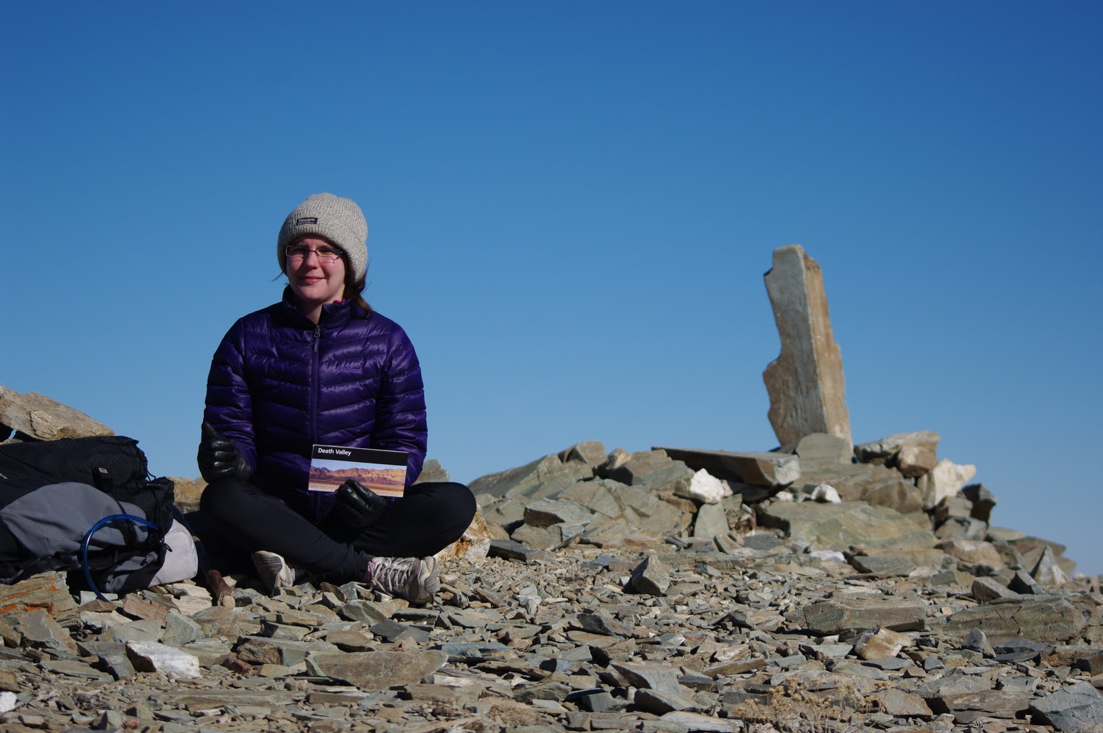
We started our Mesa Verde journey with a drive through the mesas, which in their own right are quite spectacular and unique. The horizon is painted with blue Colorado mountains, and the mesas rise stately before them. Mesa Verde is around 7,000 feet in elevation and is covered with Douglas firs, Pinyon pines, Utah juniper trees and shrubs, like Utah serviceberry. The vegetation appears as a cross between typical mountain forest (large pines) and desert vegetation (small shrubs that conserve water). The Pinyon pine is probably the most common tree in the region. These pines have adapted to conserve water in the arid conditions, and the waxy needles lose very little moisture in comparison to the broadleaf trees located in other parts of North America, such as maple and elm. The nuts of the Pinyon pine make for good eating and can be toasted, boiled or ground to mix with corn for flour.

Our first stop was at the Chapin Mesa Archaeological Museum, which houses a selection of dioramas featuring the lives of the Ancestral Puebloans. We then set off on the Petroglyph Trail aiming to reach Pictograph Point, the highlight of this trail being a panel of petroglyphs a little over a mile from the museum. The Point is actually misnamed, as the artwork on display here falls into the petroglyph category rather than pictograph; the difference being that pictographs are painted onto rock, whereas petroglyphs are carved into the rock.


Since the Ancestral Puebloans are not available to tells us the meaning of the petroglyphs at Pictograph Point, a group of four Hopi men from northeastern Arizona were asked to decipher their meaning in 1942. These men speculated that the petroglyphs tell the story of the Ancestral Puebloans migration to, and also possibly from, the area. On their reading, the animal symbols represent various clans and the lines represent the peoples' migration from the Grand Canyon (known as the “Sipapu” to Native Americans) to Mesa Verde and the various splits that occurred in the clans as the migration was undertaken. The Native Americans of the Four Corners region, believe that their ancestors emerged from the Sipapu. Obviously, it is not known if the Ancestral Puebloans would interpret the petroglyphs in the same fashion as the Hopi, but it is thought that there is an ancestral link between these two groups. One piece of evidence suggesting this continuity is the occurrence, in the ceremonial rooms, called Kivas, of both the Hopi and the Ancestral Puebloans of a small hole that symbolizes the Sipapu.

The highlight of Mesa Verde National Park is the cliff dwelling residences. We did a guided tour of Spruce Tree House with an excellent park ranger and a tour group of about fifty curious Indians from India, who had an amazing array of questions ready to ask the ranger - “What was their schooling like?”; “Did they drive?”; “Where did they go to the toilet?”; “How did they climb to the top of the mesa?”; “Can we walk into the house?”; “Can we climb down into the Kiva?” Our guide took us down to the ruins, politely answered our questions and explained certain aspects of the Ancient Puebloans culture and lifestyle to us. We learned quiet a lot on this very informative tour and hopefully the information below makes up for the comical modern history summary above.


The Spruce Tree House has 129 rooms and 8 Kivas. (A “Kiva” is a round below ground room that was predominately used for ceremonial purposes). Archaeologists speculate that up to 100 people lived at Spruce Tree House. Before the white man “discovered” it, Mesa Verde had been empty for approximately 500 years, as it is thought that the Ancients left the region in 1300 AD.

The Ancients were agriculturalists, most of their lives were dedicated to farming their land as they spent long hours in the fields cultivating their crops (sounds like my modern day parents). The crops that were grown on top of the mesas included beans, corn and squash. They reached their field by hand and toe hold trails pecked into the canyon walls. They hunted deer, rabbits, squirrel and other game and supplemented their diet with various local plants and berries. Their only domestic animals were dogs and turkeys. Turkeys were used for food, their feathers used in weaving and their bones for tools. Clothes were woven from any available fibers, including bark, plants, furs, feathers and even human hair.

The cliff dwellings were built out of sandstone bricks, individually shaped by hand. The mortar between the bricks consists of mud, straw, water and human urine. The rooms that make up the Spruce Tree House were generally 6 by 8 feet in dimension.

As mentioned above “Kiva” is the Hopi word for ceremonial room. The Kivas at Spruce Tree House took the form of underground chambers. Ancestral Puebloans may have also used the Kiva as a gathering place or a place to work in the winter. Being underground and containing a fire, the Kiva would have been the warmest room in the settlement during winters that can reach as low as 10 degrees Fahrenheit. Entry to the kiva is by ladder through a hole in the roof.

The winters at Mesa Verde were and are still brutal. The Ancients would have expended most of their energy during the winter season in keeping warm. The fires would need to be continually stoked and maintained. Many of the inside walls of the cliff dwelling structures are still blackened by smoke.

Based on modern day practice, it is thought that storytelling would have been the main source of entertainment during the long winter months (and other times of the year as well). Traders told the best stories, the most famous trader of all is Kokopelli. The petroglyph of Kokopelli is seen all over the Southwest of the USA, including at Mesa Verde. He is a hunchbacked figure with spiky hair, playing a flute and/or dancing. Kokopelli was such a popular figure that he came to be associated with god-like features. He was considered to bring good luck to villages and fertility for the crops and for the ladies.

There is evidence that the Ancestral Puebloans engaged in trade with traders from far flung areas. Seashells from the Pacific Coast, turquoise from New Mexico, pottery and cotton from other southern regions and silver work from Mexico has been found within the ruins of Mesa Verde. 

Obviously, it is difficult to know the exact truth about the lives of the Ancestral Puebloans. Archaeologists rely heavily on modern Pueblo peoples in New Mexico and Arizona for guidance on the ways of the Ancestral Puebloans. A visit to Mesa Verde National Park is highly recommended by the Green Blazing team, especially for history and UFO buffs.

Sunday, December 5, 2010

Santa Fe, New Mexico – Cuisine Dream

Santa Fe is the political and cultural center of New Mexico (State Motto: “It grows as it goes”). After our long hike down the bottom of the Grand Canyon and back, we were in need of a little TLC and a lot of New Mexican inspired cuisine. Famous for its unique green and red chillies, New Mexican cuisine is a twist on Mexican food. Burritos, enchiladas, tacos (crispy or soft) and fajitas are staples of what most restaurants offer, all covered with as much of red or green (or both) chili that you care for. You can also get the chillies roasted or stuffed with cheese.

Here is a recipe from “License to Cook New Mexico Style”:

Blue Ribbon Salsa – An authentic and basic green chili salsa

4 tomatoes, chopped fine
2 bunches of green onions, chopped fine
¾ cups chopped green chilies or to taste (these are the New Mexican green chilies)
1 sprig fresh cilantro (coriander)
¼ teaspoon salt
¼ teaspoon garlic powder
1 teaspoon vegetable oil

Combine all ingredients and refrigerate several hours for flavors to blend well. Use on tacos or tostadas, in quesadillas, as a side to any meat dish, or if you're brave, to dip tortilla chips into. The “heat” will vary, depending on the variety and quantity of chilies used.


Santa Fe and New Mexico are also famous for being the home of iconic American painter, Georgia O'Keefe, and adobe architecture. We stopped by the Georgia O'Keefe Museum for a pleasant afternoon gazing at her artwork and related materials ( http://www.okeeffemuseum.org/ ). Literally every house and building in Santa Fe is influenced by the adobe aesthetic. Here are some examples of the adobe architecture:


Photo of the Day - Four Corners, Navajo Nation

Arizona, Colorado, New Mexico, Utah - Four Corners

Photo of the Day - Monument Valley

America's most famous highway - Monument Valley in the Navajo Nation

Photo of the Day - Grand Canyon Before and After

Alex - Before

Lish - Before

Alex - After

Lish - After

Friday, December 3, 2010

Grand Canyon National Park, Arizona

 What can you say about a place like the Grand Canyon? It's probably the most famous of the 7 wonders of the natural world, but no description, pictures or documentaries can prepare you for the present feeling of looking down into it from one of the inner or outer rims. Most people feel a spirituality there and that is the only way that I can describe the profound dignity of the place. It rests there, serene, immobile, inviolate. Weather happens around it but does not affect it. It breathes in and out the days to mark time, but even that is of no consequence to it. As you stare down into the labyrinth of canyons and across to its banded walls that fall from the perfectly horizontal plateau you wonder how it was formed and then what it is that you can feel as you look down there, you feel a presence that will share the answer to the question of why. I was filled with an urge to scurry down into it, to become immersed in its crowding geology, to imbibe the details of the place and to luxuriate in its calm serenity. At the front of this urge is the desire to quell the how questions that pop up in every vista, but at base it is an urge to associate with the spiritual whole of the place. It is only through this language of spirituality that it is possible to rest down there and to get your arms around the presence that you sense when looking at the Grand Canyon. The objective explanations are patently inadequate. Yes, a river bored away at the rocks and caused rock-falls that widened the canyon over time immemorial, opposing forces working against each other endlessly and all the time gravity proving the victor and pulling the rivers closer and closer to the centre. I can see the processes and can imagine, with a leap of faith and multiplying out over millions of years that a river could do all this. But on such a scale? One river? Why? Why such grandeur, such beauty? Why carve out slender buttes and massive pinnacles and sheer cliffs of such startlingly different colours? The yearning to understand the motive for all this work is parallel to the quest for spirituality. And most importantly, there is no answer. That's the heart of the lesson.


 History
There are pictographs in the Grand Canyon that are 4,000 years old, believed to be drawn by a people called the Desert Archaics. These guys were succeeded by the Ancestral Puebloans by about 800 AD, which is about the time that the cities in Messa Verda were being built. In fact, there are ruins of adobe buildings in the canyon, including some at Phantom Ranch, which are believed to be from these Ancestral Puebloans. Many Native American tribes occupy lands in and around the canyon, including the Paiute, Navajo, Havasupai and Hualapai. Although Spanish explorers and Mormon settlers reached the Grand Canyon, it wasn't explored by Europeans until John Wesley Powell ran the Colorado all the way through the canyon in 1869. He ran the canyon again in 1872 accompanied by a photographer and an artist. This expedition generated lots of interest and by 1901 the Santa Fe Railway had built a spur line to Grand Canyon Village on the south rim. You can still ride this train to the south rim from Flagstaff. Tourism competed with mining and farming in the early years, and the declaration of the area as a national park in 1919 was bitterly opposed and blocked for 11 years. Probably the staunchest opponent of the national park, Ralph Cameron, made thousands of bogus mining claims across much of the south rim in order to secure trailheads and other tourist facilities in the area. He boasted that he would make more money out of the Grand Canyon than any other man. He launched litigation against the Federal Government alleging that the declaration of the national park was unconstitutional, was elected to the Senate in 1920 and managed to hold onto his mining claims into the 1930s. Today you can access the national park from the south rim and north rim, and can also get into the canyon through the Hualapai reservation on the west rim and the Havasupai on the east rim.


Geology
The first thing that strikes you about the Grand Canyon is the geology. It is so bare and obvious here. This is the story for how it formed: around 1,500 million years ago a tectonic plate collided with the plate that North America sits on and slid under it. However, massive volcanic mountains siting on the plate that was sliding down collided with those on the top plate and melted, forming the Vishnu bedrock that is now at the bottom of the Grand Canyon. We have no idea how geologists devised these theories, but thats what they tell us. Then the two tectonic plates reversed direction, and separated. Into the breach flowed lava, sediments (that have since been pressurized into shales) and limestone, in successive layers. These layers are called the Grand Canyon Supergroup, and as they were formed when the tectonic plates were moving apart, they are very fractured and tilted off the horizontal. That's the bottom third of the grand canyon. The rest of the canyon is made of sedimentary rocks that are still in the horizontal alignment that they were formed on, at and near the ancient coastline. Massive amounts of shells and bones form layers of limestone, silty muds from river deltas form mudstone layers, fine sands from sand dunes solidified into huge sandstone bands.

Then came the event which makes Grand Canyon special. The Rocky Mountains began to form when the North American plate rode over the Pacific plate (different plates this time but same idea). However, instead of lifting the sediment layers up unevenly like they are in the rest of the Rockies, in an area that is now roughly the four corners (intersection of Utah, Arizona, Colorado and New Mexico) they were lifted up evenly so that the layers remained horizontal. This is the Colorado Plateau that we've mentioned often before.


Finally, the Colorado River starts flowing across this plateau. Interestingly, when it started to run it flowed over huge layers of ash from the coastal volcanoes like Mt Rainier, Mt St Helen, Mt Hood, so that initially it was actually flowing above the peaks of many of the mountains that now surround it. Accordingly, the Colorado River's flow doesn't follow today's topography at all points, and at times cuts right through mountains instead of going around them. Anyway, when it got to the Colorado Plateau, the river cut into the horizontal sedimentary rock evenly. The different erosion rates of the river on these layers means that the harder layers are undermined as the river spreads out into the softer layer beneath it. The hard rock then collapses to form a cliff, and the debris from the collapse lie over the soft mud layer, protecting it from further erosion and forcing the river down instead of out wider.


This cliffs and slopes profile is apparent everywhere in the Grand Canyon, and is made possible by the horizontal alignment of the sedimentary rock. If the layers were slanted, the river would flow over the hard rocks and into the soft rocks, rather than cutting down into the harder rocks. The last thing to note is that because the rocks are sedimentary ones they erode relatively quickly into silt. This heavy silt content helps the river to erode the rock layers below. This process has been changed somewhat by the construction of the Glen Canyon Dam. The reservoir caused by the dam causes the silt to drop out of the water and the river has 90% less silt below the reservoir than above it.

Ribbon Falls

What We Did
You can walk along the rim of the canyon, but most of the walks are into the middle. We went from the North Rim, mostly because it was closer than the South Rim, but also because it is far less popular and so we'd have a better chance of getting one of the precious back-country permits that allow you to camp below the rim. The North Rim is also higher than the South Rim and shuts down in winter because of snow. We arrived during a snow storm, and the night-time temperatures on the rim was to predicted to be 14 degrees Fahrenheit that night. So naturally we were pretty keen to get going as the temperatures below the rim are significantly higher (mid-twenties above the inner rim and mid-thirties at the bottom).

Fortunately we got one of the rangers with a can-do attitude, and although we had a seven mile walk and it was 2.30pm (3 hours til dark) he was confident we could make it. So we packed hurriedly and set off on our walk. We were undertaking three nights in the canyon – one at Cottonwood Campground, about 4,000 ft below the rim and nine miles from the Colorado River, one at Bright Angel Campground next to the Colorado River, and the third back at Cottonwood before the big hike back up to the North Rim. We thought this was a pretty decent effort and were prepared for some tough times. We had read that some people do the rim-to-rim walk in a day, so we knew that we weren't world-beaters, but nonetheless, respectable. This illusion was shattered on the last day as we were hiking up out of the canyon. Around 10am we were passed by a group of very fit-looking fellas (and a sheila), one of whom told us that they were doing a rim-to-rim-to-rim run. This is a 48-mile slog with 10,000 ft of vertical separation. What did we learn? You shouldn't compare. There will always be someone harder, stronger and more crazy than you. Always.


On the way down to Cottonwood we passed Roaring Falls, which is a spring that gushes from the middle of a cliff. This spring provides the entire water supply for the Grand Canyon National Park and feeds Bright Angel Creek, along which we walked the next day to its confluence with the Colorado. The ranger at the bottom of the canyon told us that the source of the spring is unknown, although it is thought to be “fossil water”. Fossil water is groundwater that has been trapped in an aquifer for a long period of time because changing geology in the area seals it off from being replenished. It's a very clear water when it flows down Bright Angel Creek and tastes beautiful.


Cottonwood Campground is surrounded by a lovely grove of old Cottonwood trees that were planted by early settlers who ran cattle in the canyon and built the path up to the North Rim. This path is very steep and is often cut into the side of a cliff but because it was built for livestock it is quite wide and very well made. We arrived at the campground shortly after sunset and heated up the leftover spaghetti bolognese that we'd cooked at Zion and been dreaming about all the way down. It lived up to expectations and we went to bed tired, full and happy.


Next day was a pleasant walk down the Bright Angel Canyon to Phantom Ranch, which is a tourist ranch that has a canteen, cabins, ranger station and mule corals. The ranch was originally designed as a dude ranch by Mary Colter and built by the Civilian Conservation Corps. (CCC) in the 1930s. The CCC was created during the Great Depression to give work to the legion of unemployed young men. Most of the trails, roads, bridges and lodges in the national parks that we've visited were constructed during the 1930s by the CCC. Today Phantom Ranch is run by a concessionaire (Xanterra), but it still looks like a dude ranch. One of the services that Phantom Ranch offers is to haul your bags on the mule trains that head to the South Rim and back every day (I think you can even ride these mules). These mules are the only means of transporting goods in and out of phantom ranch, and they're an integral part of the Grand Canyon experience. The people who work at the ranch have to walk in and out if they want to spend their days off away from the ranch. The cashier at the canteen told us that he'd been working there for a year and been out of the canyon only three times. He told us he was “at rock bottom and lovin' it!” - we didn't doubt him.


The Bright Angel Campground is next to the ranch and lots of people camping there eat at the cafeteria and attend the ranger presentations that are given twice a day. Different presentations are given each day, mostly on the local fauna and flora, history and geology. While we were there they were conducting a program to eliminate the brown trout from Bright Angel Creek and the Colorado River. The brown trout is an introduced species that is out-competing native fish, including the endangered Humpback Chub, which is found only in the Colorado River. They'd constructed a fish weir at the creek to trap these brown trout. The Havasupai tribe that agreed to allow this fish trap to be built insisted on the condition that all fish that were caught in the trap must be consumed. So you can get yourself a free feed of trouts at Bright Angel Campground if you're happy to cook them.


The main part of the Grand Canyon walk is the hike out. It hangs over you all the way down and while you're on the bottom. It is probably the subject of nervous questions on every ranger presentation (was for ours) and the yardstick by which all other days on the walk are measured. We had been planning our water and food the whole time so we'd have the lightest packs possible without taking undue risk. The key is to start early and drink lots of water. We thought we were up early but half of the camp had left as we walked out at 9am. Because we were so focused on the walk it was actually easier than anticipated. It's easier on the joints than walking down, but the pack starts to feel very heavy towards lunch time. It was also on the walk out that we were passed by the rim-to-rim-to-rim'ers and so our suffering paled next to theirs. If you have the presence of mind to look up from under your pack as you go, this walk is amazing. You're walking forward in geological time through the successive layers of sediments. Signs beside the trail at the meeting of these layers tell you about the formation of the rocks and which fossils you should be looking out for. In truth, though, this distraction wears out pretty soon and for the last few layers you're just yearning for the top.


Once the top is reached and the pack is dumped, the aches and discomforts which saturated your consciousness on the way up melt under the warm wash of liberation and accomplishment. We rode this feeling to the visitor center and lodge. Unfortunately the lodge was closed for the season so we had to wait for that massive first meal that always bookends a good hike. However, the view from the lodge was not closed, and because it was snowing on our way down, we hadn't seen the canyon from the north rim before. It is an incredible situation for a lodge (apparently it books out on the day reservations open, 13 months in advance), right on the rim of the canyon, on a butte that sticks out between the Bright Angel Canyon – which we walked up – and the Transect Canyon. We took the trail to Bright Angel Point (another trail with a lot of exposure), which is right at the end of the butte. It feels like you're on the prow of a massive ship steaming through the huge open spaces that dominate the grand canyon. You can see the entire trail that we'd walked for four days, the south rim, the San Franciscan Peaks near Albuquerque, a lone peak in the Navajo Nation called Humphreys Peak and surrounding you everywhere is the confounding, majestic symmetry of the Grand Canyon.